IMAGES TAKEN NEAR TO
Ham Hill, RADSTOCK, BA3 5QD
Introduction
This page details the photographs taken nearby to Ham Hill, BA3 5QD by members of the Geograph project.
The Geograph project started in 2005 with the aim of publishing, organising and preserving representative images for every square kilometre of Great Britain, Ireland and the Isle of Man.

There are currently over 7.5m images from over14,400 individuals and you can help contribute to the project by visiting https://www.geograph.org.uk
Image Map
Images are licensed for reuse under creativecommons.org/licenses/by-sa/2.0
Notes
- Clicking on the map will re-center to the selected point.
- The higher the marker number, the further away the image location is from the centre of the postcode.
Image Listing (8 Images Found)
Images are licensed for reuse under creativecommons.org/licenses/by-sa/2.0
Image
Details
Distance
2
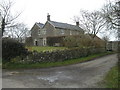
Holcombe, Common Lane
House at the junction of Common Lane, Ham Hill and Springers Hill.
The House is called Kilmersdon Common Farm
Image: © ChurchCrawler
Taken: 16 Mar 2006
0.15 miles
3
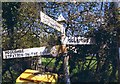
Old Direction Sign - Signpost by Common Lane, Coleford parish
Pyramid finial - 3 arms; Somerset SCC pyramid by the UC road, in parish of Coleford (Mendip District), Common Lane junction with Becks Lane and Ham Hill, near Kilmersdale Common Farm.
Surveyed
Milestone Society National ID: SO_ST6748B
Image: © Milestone Society
Taken: Unknown
0.15 miles
4
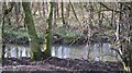
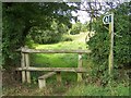
The Mells Stream between Edford and Ham
Image: © Dr Duncan Pepper
Taken: 15 Jan 2016
0.20 miles
5

2009 : Pasture north of Whitehole Hill
The valley holds the Mells Stream as it travels east to Vobster then on to Mells and Great Elm, then it qualifies as a river and empties into the River Frome near Spring Gardens.
Image: © Maurice Pullin
Taken: 1 May 2009
0.21 miles
6
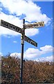
Direction Sign - Signpost at Ham
Lost finial - 3 arms; Somerset SCC pyramid by the UC road, in parish of Coleford (Mendip District), on the southwest side of the T junction of Marsh Lane, Ham Hill and Whitehole Hill at Ham.
surveyed
Milestone Society National ID: SO_ST6748A
Image: © Milestone Society
Taken: Unknown
0.24 miles