
IMAGES TAKEN NEAR TO
Fosse Green, RADSTOCK, BA3 3BH
Introduction
This page details the photographs taken nearby to Fosse Green, BA3 3BH by members of the Geograph project.
The Geograph project started in 2005 with the aim of publishing, organising and preserving representative images for every square kilometre of Great Britain, Ireland and the Isle of Man.

There are currently over 7.5m images from over14,400 individuals and you can help contribute to the project by visiting https://www.geograph.org.uk
Image Map
Images are licensed for reuse under creativecommons.org/licenses/by-sa/2.0
Notes
- Clicking on the map will re-center to the selected point.
- The higher the marker number, the further away the image location is from the centre of the postcode.
Image Listing (26 Images Found)
Images are licensed for reuse under creativecommons.org/licenses/by-sa/2.0
Image
Details
Distance
1
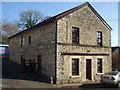
Part of the expanding story
Clandown history is woven with coal mining, as is much of this part of the world. There were several pits opened over time and the various efforts to bring coal to the surface resulted in some notable expansions. This sturdy building dates from 1910 and is part of the latter days of mining.
Image: © Neil Owen
Taken: 25 Feb 2019
0.03 miles
2
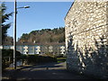
A view from Coombe End, Clandown
Contrasting housing: the later terracing (further off on Fosse Green) is clearly post-war, whereas the stone wall to the right is Old Pit Terrace. The latter refers to an old workings that used to be in front of the houses in the past. See Image] for a benchmark that can be found at the foot of the stone wall.
Image: © Neil Owen
Taken: 25 Feb 2019
0.05 miles
3
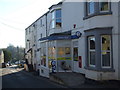
A shop on the Fosse Way
It may look like a typical village scene, but this road is actually the old Roman road.
Image: © Neil Owen
Taken: 25 Feb 2019
0.06 miles
4
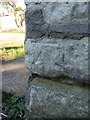
Benchmark on Old Pit Terrace
This somewhat weathered cutmark is listed in the Benchmark Database: https://www.bench-marks.org.uk/bm104977 . See Image] for a contextual view.
Image: © Neil Owen
Taken: 25 Feb 2019
0.06 miles
5
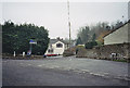
Road Junction, Clandown with The Lamb Inn in the background
Image: © Dominic Dawn Harry and Jacob Paterson
Taken: 19 Feb 2006
0.06 miles
6

A dark corner of the Lamb Hotel
An interesting bit of architecture, perhaps sitting lower to the ground than when first built.
Image: © Neil Owen
Taken: 25 Feb 2019
0.07 miles
7

The Lamb Hotel in Clandown
Close to the centre of the village and right on the Fosse Way.
Image: © Neil Owen
Taken: 25 Feb 2019
0.07 miles
8
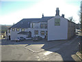
The Lamb Hotel, Clandown
Clandown's long-established heart, the Lamb Inn retains a lot of its characteristics. See Image] for a benchmark on the wall right of shot.
Image: © Neil Owen
Taken: 25 Feb 2019
0.08 miles
9
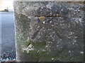
Benchmark on the Lamb Hotel
This old cutmark is listed in the Benchmark Database: https://www.bench-marks.org.uk/bm104978 . See Image] for a view of the hotel.
Image: © Neil Owen
Taken: 25 Feb 2019
0.08 miles
10
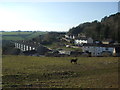
Southern slopes of Clandown
The hillside above the old colliery village is home to many horses. This one prefers a little space.
Image: © Neil Owen
Taken: 25 Feb 2019
0.08 miles