
IMAGES TAKEN NEAR TO
Dunkerton, BATH, BA2 8BW
Introduction
This page details the photographs taken nearby to BA2 8BW by members of the Geograph project.
The Geograph project started in 2005 with the aim of publishing, organising and preserving representative images for every square kilometre of Great Britain, Ireland and the Isle of Man.

There are currently over 7.5m images from over14,400 individuals and you can help contribute to the project by visiting https://www.geograph.org.uk
Image Map
Images are licensed for reuse under creativecommons.org/licenses/by-sa/2.0
Notes
- Clicking on the map will re-center to the selected point.
- The higher the marker number, the further away the image location is from the centre of the postcode.
Image Listing (46 Images Found)
Images are licensed for reuse under creativecommons.org/licenses/by-sa/2.0
Image
Details
Distance
2
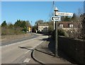
A387 near Dunkerton
The former Old Swan Inn is the next building along the main road.
Image: © Derek Harper
Taken: 24 Feb 2016
0.01 miles
4
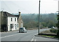
2008 : The turning to Dunkerton
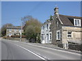
In Image] we see the A367 as it approaches the bridge over the Cam Brook.
Reversing a hundred yards or so we have this scene with the turning to Dunkerton village in the foreground.
Image: © Maurice Pullin
Taken: 22 Apr 2008
0.02 miles
5
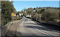
A367 at Dunkerton Bridge
The main road approaching the junction where Image] was taken. The parapets of the bridge (which is over the Cam Brook) are in the foreground.
Image: © Derek Harper
Taken: 24 Feb 2016
0.02 miles
6
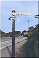
Old Direction Sign - Signpost by the A367, Dunkerton Parish
Pyramid finial - 1 arm; Somerset SCC pyramid by the A367, in parish of Dunkerton (Bath And North East Somerset District), junction of lane to Combe Hay, just North of Dunkerton Bridge.
Surveyed
Milestone Society National ID: SO_ST7159
Image: © Milestone Society
Taken: Unknown
0.03 miles
7
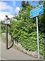
Signs up from Dunkerton Bridge
The A367 runs across the bridge of the Cam Brook, with these signs at the junction close to the former Swan Inn.
Image: © Neil Owen
Taken: 24 May 2022
0.03 miles
8
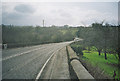
A367, Dunkerton Looking Towards Peasedown St John
Image: © Dominic Dawn Harry and Jacob Paterson
Taken: 19 Feb 2006
0.04 miles
9
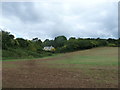
From the coal statue to the coal canal (50)
Field near Dunkerton Bridge
Image: © Basher Eyre
Taken: 14 Sep 2013
0.04 miles
10
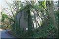
Bridge abutment, Dunkerton
The east side of what was a bridge carrying the Camerton Branch of the Bristol and North Somerset Railway, by the lane to Combe Hay. The identification sign reads "CMZ 5-33".
Image: © Derek Harper
Taken: 24 Feb 2016
0.05 miles