
IMAGES TAKEN NEAR TO
Willow Close, BATH, BA2 2DZ
Introduction
This page details the photographs taken nearby to Willow Close, BA2 2DZ by members of the Geograph project.
The Geograph project started in 2005 with the aim of publishing, organising and preserving representative images for every square kilometre of Great Britain, Ireland and the Isle of Man.

There are currently over 7.5m images from over14,400 individuals and you can help contribute to the project by visiting https://www.geograph.org.uk
Image Map
Images are licensed for reuse under creativecommons.org/licenses/by-sa/2.0
Notes
- Clicking on the map will re-center to the selected point.
- The higher the marker number, the further away the image location is from the centre of the postcode.
Image Listing (10 Images Found)
Images are licensed for reuse under creativecommons.org/licenses/by-sa/2.0
Image
Details
Distance
1

A broad green strip
Although the modern housing has encroached on the open spaces, this linear bit of green land retains the route of the old Wansdyke. The ancient ditch has become indistinguishable from the rest of the countryside. This area was once a Fuller's Earth works, and later quarrying became a feature.
Image: © Neil Owen
Taken: 17 Jan 2018
0.04 miles
2
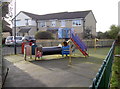
Ridge Green play area
Located at the end of a street.
Image: © Neil Owen
Taken: 17 Jan 2018
0.13 miles
3
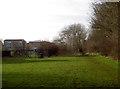
The Wansdyke near St Gregory's Catholic College
Now no more than a simple footpath along hedges, the old Wansdyke maintains a straight path. The college was previously known as Cardinal Newman school (secondary modern).
Image: © Neil Owen
Taken: 17 Jan 2018
0.13 miles
4
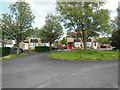
The end of Oolite Grove
This unexceptional suburban cul-de-sac bears what is surely Bath's best street name. Oolite Grove has supplied the title of a track by Ozric Tentacles. Dictionaries say that the first word should be pronounced as three syllables, but in practice it is always 'oooh-light'. Bath is built on and of it.
Image: © HelenK
Taken: 15 May 2014
0.18 miles
5
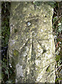
Rivet benchmark on the Wansdyke
A rivet benchmark, as listed in the Benchmark Database: http://www.bench-marks.org.uk/bm92083 , remains on a small stone wall on the Wansdyke path on Bath's southern downland. It is on a junction of paths and close to the Three Ways School. The latter is a modern (2007) school for special needs pupils. Before that there were a number of individual establishments, and the original school was founded in the early twentieth century as Three Ways Cottages; this was a part of the nearby Poor Law Workhouse and a Bath Corporation institution.
See Image] for a wider view.
Image: © Neil Owen
Taken: 17 Jan 2018
0.21 miles
6
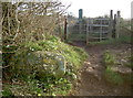
Three ways at Three Ways
A footpath junction along the Wansdyke, close to Three Ways school. A post WWII benchmark lies on the stone wall - see Image
Image: © Neil Owen
Taken: 17 Jan 2018
0.21 miles
7
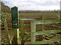
Manor Farm permissibles
The old estate has largely been given over to agriculture, although some of the land is now planted with trees and some permissible paths are offered to walkers.
Image: © Neil Owen
Taken: 17 Jan 2018
0.23 miles
8

Ordnance Survey Cut Mark
This OS cut mark can be found on the wall NE side of Frome Road. It marks a point 164.619m above mean sea level.
Image: © Adrian Dust
Taken: 16 Nov 2022
0.23 miles
9
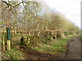
Plenty of trees to play around
The Manor Farm estate comprises many acres of land, some of which were devoted to farming crops but have now been turned over to trees. Several permissive paths now cross the plantations. Otherwise, the footpath carries on down to South Stoke.
Image: © Neil Owen
Taken: 17 Jan 2018
0.23 miles
10

The track near Sulis Manor
The area to the west of South Stoke was largely part of the estate. This track remains part of the access to what is now a fairly open area for all to enjoy, along with a lot of tree planting.
Image: © Neil Owen
Taken: 8 Mar 2021
0.23 miles