IMAGES TAKEN NEAR TO
Chilthorne Domer, YEOVIL, BA22 8QZ
Introduction
This page details the photographs taken nearby to BA22 8QZ by members of the Geograph project.
The Geograph project started in 2005 with the aim of publishing, organising and preserving representative images for every square kilometre of Great Britain, Ireland and the Isle of Man.

There are currently over 7.5m images from over14,400 individuals and you can help contribute to the project by visiting https://www.geograph.org.uk
Image Map
Images are licensed for reuse under creativecommons.org/licenses/by-sa/2.0
Notes
- Clicking on the map will re-center to the selected point.
- The higher the marker number, the further away the image location is from the centre of the postcode.
Image Listing (2 Images Found)
Images are licensed for reuse under creativecommons.org/licenses/by-sa/2.0
Image
Details
Distance
1
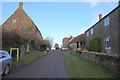
Chilthorne Hill
Hill Farm is on the left and the westerly grid line runs along the line of the farmhouse parallel to the street so that part of the farm is in ST5119. The street turns into a track leading north down to fields in the vale beyond the hill.
Image: © Nigel Mykura
Taken: 26 Dec 2017
0.08 miles
2
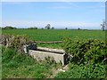
Fields near Chilthorne Domer.
View north west towards Sock Farm from the lane from Axesclose to Chilthorne Hill
Image: © Nigel Mykura
Taken: 21 Apr 2009
0.18 miles