IMAGES TAKEN NEAR TO
Tintinhull Road, YEOVIL, BA22 8QU
Introduction
This page details the photographs taken nearby to Tintinhull Road, BA22 8QU by members of the Geograph project.
The Geograph project started in 2005 with the aim of publishing, organising and preserving representative images for every square kilometre of Great Britain, Ireland and the Isle of Man.

There are currently over 7.5m images from over14,400 individuals and you can help contribute to the project by visiting https://www.geograph.org.uk
Image Map
Images are licensed for reuse under creativecommons.org/licenses/by-sa/2.0
Notes
- Clicking on the map will re-center to the selected point.
- The higher the marker number, the further away the image location is from the centre of the postcode.
Image Listing (5 Images Found)
Images are licensed for reuse under creativecommons.org/licenses/by-sa/2.0
Image
Details
Distance
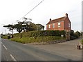
4
Axesclose, Chilthorne Domer
View south towards Axesclose from the road running north to Chilthorne Hill.
Image: © Nigel Mykura
Taken: 21 Apr 2009
0.11 miles
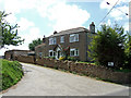
5
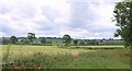
Farmland near Chilthorne Domer
The level upper valley of Ball's Water, seen from the old main road between Tintinhull Forts and Chilthorne Domer.
Image: © Derek Harper
Taken: 9 Jun 2010
0.22 miles