
IMAGES TAKEN NEAR TO
Sladebrook Road, BATH, BA2 1LP
Introduction
This page details the photographs taken nearby to Sladebrook Road, BA2 1LP by members of the Geograph project.
The Geograph project started in 2005 with the aim of publishing, organising and preserving representative images for every square kilometre of Great Britain, Ireland and the Isle of Man.

There are currently over 7.5m images from over14,400 individuals and you can help contribute to the project by visiting https://www.geograph.org.uk
Image Map
Images are licensed for reuse under creativecommons.org/licenses/by-sa/2.0
Notes
- Clicking on the map will re-center to the selected point.
- The higher the marker number, the further away the image location is from the centre of the postcode.
Image Listing (11 Images Found)
Images are licensed for reuse under creativecommons.org/licenses/by-sa/2.0
Image
Details
Distance
1
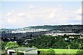
Panorama of Bath from Southdown, 1966
Taken from my lodgings when doing a student holiday job. The open space in the foreground and the trees have disappeared under later housing development. The sunlit area left of centre is the city centre, with the Abbey visible over the right hand part of the garage roof.
Image: © Alan Murray-Rust
Taken: 13 Jul 1966
0.09 miles
2
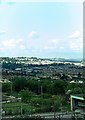
Panorama of Bath from Southdown, 1966
Looking towards Lansdown Hill to the left. Royal Crescent is clearly visible right in the centre of the picture with the tower of St Stephen's Church, Lansdown Road, a bit higher to the left rising above Lansdown Crescent. The row of semi-detached houses on the left are on The Hollow. Above the garage can be seen the glasshouses of Twerton Nurseries. All the foreground green area has been replaced by a later housing development.
Taken from my lodgings when I was doing a student vacation job in Bath.
Image: © Alan Murray-Rust
Taken: 13 Jul 1966
0.11 miles
3

Shops at Southdown
A view looking to the southeast along The Mount towards the shops at Southdown.
Image: © Phil Williams
Taken: 9 Mar 2007
0.15 miles
4
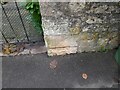
Ordnance Survey Cut Mark
This OS cut mark can be found on the gatepost of No70 Mount Road. It marks a point 114.521m above mean sea level.
Image: © Adrian Dust
Taken: 2 Dec 2022
0.17 miles
5
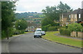
2008 : Kelston View, Whiteway, Bath
There is no such thing as an "ordinary" street in Bath.
Image: © Maurice Pullin
Taken: 14 Jul 2008
0.19 miles
6
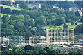
2008 : North east from Trigpoint 6624
Using the trigpoint pillar as a convenient camera support we have a clear view of the gasholders near Windsor Bridge between Upper Bristol Road and Lower Bristol Road.
Royal Victoria Park and High Common give a rural appearance.
Image: © Maurice Pullin
Taken: 14 Jul 2008
0.20 miles
7

Ordnance Survey Cut Mark
This OS cut mark can be found on No20 The Circle. It marks a point 112.949m above mean sea level.
Image: © Adrian Dust
Taken: 2 Dec 2022
0.21 miles
8
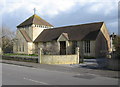
Southdown Methodist Church
A view looking east across The Hollow, towards the Methodist Church at Southdown.
Image: © Phil Williams
Taken: 9 Mar 2007
0.22 miles
9
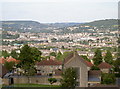
In between the hills
Looking from Southdown, past St Barnabas church in the foreground and onto the city of Bath, nestled between the many surrounding hills.
Image: © Neil Owen
Taken: 21 Jul 2008
0.22 miles
10

Southdown Methodist Church Centre
The nearby Methodist church in Oldfield Park closed a few years ago, but the church remains active in the area at this complex of church buildings.
Image: © HelenK
Taken: 14 Sep 2013
0.23 miles