2008 : North east from Trigpoint 6624
Introduction
The photograph on this page of 2008 : North east from Trigpoint 6624 by Maurice Pullin as part of the Geograph project.
The Geograph project started in 2005 with the aim of publishing, organising and preserving representative images for every square kilometre of Great Britain, Ireland and the Isle of Man.

There are currently over 7.5m images from over 14,400 individuals and you can help contribute to the project by visiting https://www.geograph.org.uk
2008 : North east from Trigpoint 6624
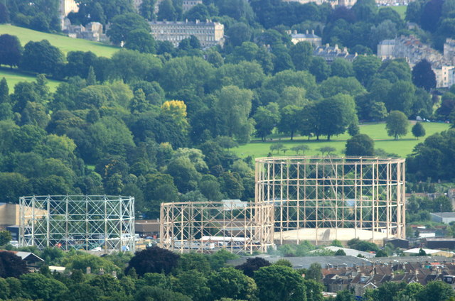
Image: © Maurice Pullin Taken: 14 Jul 2008
Using the trigpoint pillar as a convenient camera support we have a clear view of the gasholders near Windsor Bridge between Upper Bristol Road and Lower Bristol Road. Royal Victoria Park and High Common give a rural appearance.
Images are licensed for reuse under creativecommons.org/licenses/by-sa/2.0
Image Location
Latitude
51.369534
Longitude
-2.394563