
IMAGES TAKEN NEAR TO
Fairway View, YEOVIL, BA21 5AD
Introduction
This page details the photographs taken nearby to Fairway View, BA21 5AD by members of the Geograph project.
The Geograph project started in 2005 with the aim of publishing, organising and preserving representative images for every square kilometre of Great Britain, Ireland and the Isle of Man.

There are currently over 7.5m images from over14,400 individuals and you can help contribute to the project by visiting https://www.geograph.org.uk
Image Map
Images are licensed for reuse under creativecommons.org/licenses/by-sa/2.0
Notes
- Clicking on the map will re-center to the selected point.
- The higher the marker number, the further away the image location is from the centre of the postcode.
Image Listing (55 Images Found)
Images are licensed for reuse under creativecommons.org/licenses/by-sa/2.0
Image
Details
Distance
1
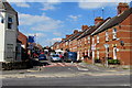
Victoria Road, Yeovil
Viewed across Lyde Road from the corner of Camborne Grove.
A 20mph zone is in force on the approach to a school.
The blue sign on the left shows that Victoria Road is unsuitable for heavy goods vehicles.
Image: © Jaggery
Taken: 10 Sep 2015
0.10 miles
2
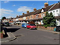
Camborne Street, Yeovil
Viewed from the corner of Camborne Place looking along Camborne Street towards Lyde Road in the Pen Hill area of Yeovil.
Image: © Jaggery
Taken: 10 Sep 2015
0.13 miles
3

Lyde Road houses, Yeovil
The house on the right is on the corner of Victoria Road.
Image: © Jaggery
Taken: 10 Sep 2015
0.14 miles
4
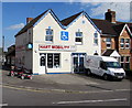
Hart Mobility shop in Yeovil
The shop on the corner of Camborne Grove and Lyde Road sells mobility
scooters, wheelchairs, rise & recline chairs, stairlifts, walking aids etc.
Image: © Jaggery
Taken: 10 Sep 2015
0.15 miles
5
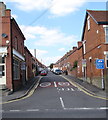
Southern end of Cromwell Road, Yeovil
Viewed across Lyde Road. The 30mph speed limit drops to 20mph on the approach to a school.
The blue sign on the right shows that this is an unsuitable route for heavy goods vehicles.
Image: © Jaggery
Taken: 10 Sep 2015
0.15 miles
6
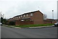
Housing, Roseberry Rd Yeovil
This housing is at the junction of Roseberry Avenue and Clifton Close on the Eastern side of yeovil
Image: © Nigel Mykura
Taken: 31 Jan 2009
0.16 miles
7

Lyde Road houses, Yeovil
On the north side of the road, between Cromwell Road and Victoria Road.
Image: © Jaggery
Taken: 10 Sep 2015
0.17 miles
8
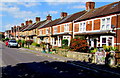
Camborne Grove houses, Yeovil
Looking NW towards Lyde Road from near the Great Western pub. http://www.geograph.org.uk/photo/4655624
Image: © Jaggery
Taken: 10 Sep 2015
0.17 miles
9

The Royal Marine Inn, Yeovil
This inn has been trading in Yeovil since 1886.
Image: © Steve Barnes
Taken: 12 Aug 2009
0.17 miles
