
IMAGES TAKEN NEAR TO
Eastland Road, YEOVIL, BA21 4ET
Introduction
This page details the photographs taken nearby to Eastland Road, BA21 4ET by members of the Geograph project.
The Geograph project started in 2005 with the aim of publishing, organising and preserving representative images for every square kilometre of Great Britain, Ireland and the Isle of Man.

There are currently over 7.5m images from over14,400 individuals and you can help contribute to the project by visiting https://www.geograph.org.uk
Image Map
Images are licensed for reuse under creativecommons.org/licenses/by-sa/2.0
Notes
- Clicking on the map will re-center to the selected point.
- The higher the marker number, the further away the image location is from the centre of the postcode.
Image Listing (103 Images Found)
Images are licensed for reuse under creativecommons.org/licenses/by-sa/2.0
Image
Details
Distance
1
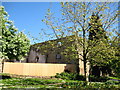
Redevelopment of industrial building - Yeovil
Rebuilding has started on this old stone edifice at the bottom of Reckleford.
Image: © Sarah Smith
Taken: 1 May 2009
0.06 miles
2
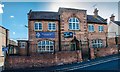
Yeovil: Drill Hall in Southville
Image: © Mr Eugene Birchall
Taken: 13 Jul 2014
0.06 miles
3
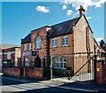
Yeovil: Drill Hall in Southville
Image: © Mr Eugene Birchall
Taken: 13 Jul 2014
0.06 miles
4

Army Reserve Centre, Yeovil
On Southville.
Image: © Robin Webster
Taken: 3 Nov 2018
0.06 miles
5
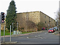
Former industry - Yeovil
Yeovil used to be big in the leather industry but with the exception of Pittards on the outskirts of town, the industry has gone and left a variety of standing buildings as well as one significant works that has been lost since 1996 (see - Image).
I believe this is the former tannery of the Perrin Leather Co. That was dated 1853 and originally had a top storey with traditional wooden louvres for ventilation.
Image: © Chris Allen
Taken: 27 Dec 2016
0.06 miles
6
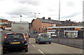
Traffic lights on A30 just east of hospital
Image: © John Firth
Taken: 12 Apr 2013
0.07 miles

8
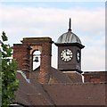
The roof of Reckleford School, Yeovil
To give it the full name, Reckleford Community School and Nursery. The roof has a bell and clock turret
Image: © David Smith
Taken: 2 Oct 2014
0.08 miles
10

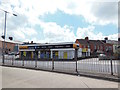
Yeovil Fire and Ambulance Station Reckleford
View up Reckleford from the bottom of the dual carriageway with the Fire Station on the left. The downhill (easterly) side of the road is reduced to one lane with cones because of the demolition work taking place just behind the photographer to upgrade the first part of the Sherbrone Rd where the premises of Cooker King used to stand.
Image: © Nigel Mykura
Taken: 11 Sep 2009
0.10 miles