
IMAGES TAKEN NEAR TO
The Square, BATH, BA2 0HY
Introduction
This page details the photographs taken nearby to The Square, BA2 0HY by members of the Geograph project.
The Geograph project started in 2005 with the aim of publishing, organising and preserving representative images for every square kilometre of Great Britain, Ireland and the Isle of Man.

There are currently over 7.5m images from over14,400 individuals and you can help contribute to the project by visiting https://www.geograph.org.uk
Image Map
Images are licensed for reuse under creativecommons.org/licenses/by-sa/2.0
Notes
- Clicking on the map will re-center to the selected point.
- The higher the marker number, the further away the image location is from the centre of the postcode.
Image Listing (64 Images Found)
Images are licensed for reuse under creativecommons.org/licenses/by-sa/2.0
Image
Details
Distance
1

The Connies, Timsbury
A tea room in The Square. Next door is a fish and chip shop.
Image: © Derek Harper
Taken: 9 Dec 2019
0.00 miles
2
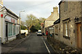
High Street, Timsbury
On the immediate right is the former post office. The High Street leads into The Square, which is roughly triangular.
Image: © Derek Harper
Taken: 9 Dec 2019
0.02 miles
3
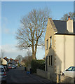
House on Newmans Lane, Timsbury
A new house north of The Square.
Image: © Derek Harper
Taken: 9 Dec 2019
0.02 miles
4
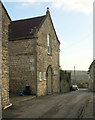
Former Christadelphian meeting house, Timsbury
"Five of the local inhabitants ... formed the nucleus of the Christadelphian Meeting. Their first breaking of the bread meeting was held at a private house, Belle Vue. However, by 1931 they had acquired the old Congregational Chapel built in 1825 ... In 1980 during re-roofing, the original thatch roof was discovered ...
In 2004 the Chapel was converted to a residential dwelling" http://www.timsbury.org.uk/history-christadelphian-chapel/ . This is on Maggs Hill.
Image: © Derek Harper
Taken: 9 Dec 2019
0.04 miles
5
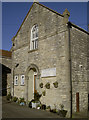
The old Christadelphian Church
Originally founded in 1825 as the Congregational Church, it was occupied for about a century before the whole crowd relocated to the new building in North Road. The village also had a small but hardy Baptist movement springing up from the 1920s. After this church became vacant, they took over and established themselves, offering Sunday charabanc rides amongst other things. In the 1980s, the roof was repaired and it was discovered that there was thatching underneath the tiles. However, as with so many small throngs, the church closed in 2004 and is now a private residence.
Image: © Neil Owen
Taken: 9 Feb 2015
0.04 miles
6
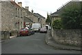
2007 : High Street, Timsbury
Timsbury is mentioned in the Domesday Book.
From about 1800 it was a mining town in the North Somerset coalfield, this has now ceased.
St. Mary's Church is at the far end of High Street.
Image: © Maurice Pullin
Taken: 10 Jul 2007
0.06 miles
8

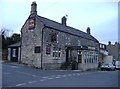
Crock Barton, Timsbury
A reverse view of Image] along footpath CL 21/43 towards Rectory Lane. Crock Barton, the listed listed terrace on the left, is described at https://historicengland.org.uk/listing/the-list/list-entry/1135990 .
Image: © Derek Harper
Taken: 9 Dec 2019
0.07 miles
9
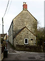
Crock Barton, Timsbury
The end of a listed terrace described at https://historicengland.org.uk/listing/the-list/list-entry/1135990 . Rectory Lane performs a right-angled bend in front of the camera, while footpath CL 21/43 continues ahead past the terrace and along Chapel Walk; the footpath sign on the left would suggest it goes right.
Image: © Derek Harper
Taken: 9 Dec 2019
0.07 miles
10
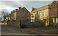
Houses on High Street, Timsbury
On the left is Pitfour Terrace, shown in Image On the right is the mid C17 Pitfour House https://historicengland.org.uk/listing/the-list/list-entry/1129599 , with information on the former occupants at http://www.timsbury.org.uk/pitfour-house/ . The gatepiers with ball finials, rather hidden in shadow on the left, are also listed https://historicengland.org.uk/listing/the-list/list-entry/1136004 .
Image: © Derek Harper
Taken: 9 Dec 2019
0.07 miles