Houses on High Street, Timsbury
Introduction
The photograph on this page of Houses on High Street, Timsbury by Derek Harper as part of the Geograph project.
The Geograph project started in 2005 with the aim of publishing, organising and preserving representative images for every square kilometre of Great Britain, Ireland and the Isle of Man.

There are currently over 7.5m images from over 14,400 individuals and you can help contribute to the project by visiting https://www.geograph.org.uk
Houses on High Street, Timsbury
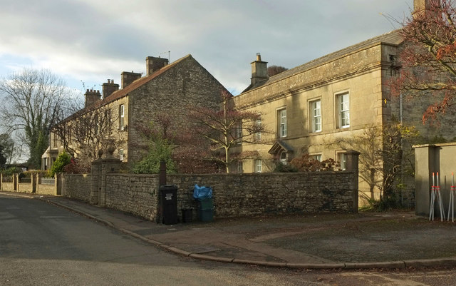
Image: © Derek Harper Taken: 9 Dec 2019
On the left is Pitfour Terrace, shown in Image On the right is the mid C17 Pitfour House https://historicengland.org.uk/listing/the-list/list-entry/1129599 , with information on the former occupants at http://www.timsbury.org.uk/pitfour-house/ . The gatepiers with ball finials, rather hidden in shadow on the left, are also listed https://historicengland.org.uk/listing/the-list/list-entry/1136004 .
Images are licensed for reuse under creativecommons.org/licenses/by-sa/2.0
Image Location
Latitude
51.326154
Longitude
-2.477717