
IMAGES TAKEN NEAR TO
South Street, YEOVIL, BA20 1QF
Introduction
This page details the photographs taken nearby to South Street, BA20 1QF by members of the Geograph project.
The Geograph project started in 2005 with the aim of publishing, organising and preserving representative images for every square kilometre of Great Britain, Ireland and the Isle of Man.

There are currently over 7.5m images from over14,400 individuals and you can help contribute to the project by visiting https://www.geograph.org.uk
Image Map
Images are licensed for reuse under creativecommons.org/licenses/by-sa/2.0
Notes
- Clicking on the map will re-center to the selected point.
- The higher the marker number, the further away the image location is from the centre of the postcode.
Image Listing (246 Images Found)
Images are licensed for reuse under creativecommons.org/licenses/by-sa/2.0
Image
Details
Distance
1
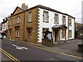
Town Council Offices Yeovil.
Former Old Police station
Image: © Brian Roberts
Taken: 28 Aug 2008
0.01 miles
2
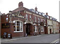
The Globe and Crown
Formerly The Globetrotter.
Image: © Neil Owen
Taken: 5 Jun 2013
0.02 miles
3
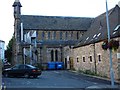
Converted Church
This former church has been converted into some form of multiple occupancy dwelling hence the fire escape.
Image: © Steve Barnes
Taken: 23 Jul 2009
0.02 miles
4

Yeovil: King George Street at Night
Image: © Mr Eugene Birchall
Taken: 26 Jan 2010
0.02 miles
6
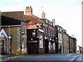
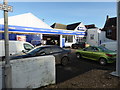
South Street Yeovil
Always known as South Street but sometimes in the past referred to as Back Street. The junction on the left is the bottom of Penn Hill. The Globe and Crown pub can be seen followed by apartments then the Newman Memorial Hall.
Image: © Sarah Smith
Taken: 13 Jan 2009
0.03 miles
7

Bell tower and weather vane King George Street
This is situated on the roof of Barclays Bank next to the post office. The photograph was taken from across the road in South Street.
Image: © Sarah Smith
Taken: 10 Jul 2008
0.03 miles
8

King George Street - Yeovil
Originally known as George Court after the name of a George Inn which used to stand on the junction with the High Street. All the old buildings of the street were demolished in 1928 and in their place these municipal-styled sandstone buildings were built and the name King George Street applied. The area is pedestrianised.
The tower of St John's Church can be seen over the buildings in the High Street.
Image: © Sarah Smith
Taken: 30 Dec 2008
0.03 miles
9
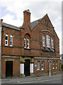
South Street Centre
This started life in 1889 as 'The Victoria Temperance Hall'. In the early part of the twentieth century it changed into an arts and science school and now it is a day centre. Help is offered to all members of society but especially the over-60s.
Image: © Neil Owen
Taken: 5 Jun 2013
0.03 miles
10
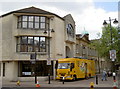
Sit in, takeaway or delivery?
Somerset library service, in all its forms.
Image: © Neil Owen
Taken: 5 Jun 2013
0.04 miles