
IMAGES TAKEN NEAR TO
Lansdown, BATH, BA1 9BW
Introduction
This page details the photographs taken nearby to BA1 9BW by members of the Geograph project.
The Geograph project started in 2005 with the aim of publishing, organising and preserving representative images for every square kilometre of Great Britain, Ireland and the Isle of Man.

There are currently over 7.5m images from over14,400 individuals and you can help contribute to the project by visiting https://www.geograph.org.uk
Image Map
Images are licensed for reuse under creativecommons.org/licenses/by-sa/2.0
Notes
- Clicking on the map will re-center to the selected point.
- The higher the marker number, the further away the image location is from the centre of the postcode.
Image Listing (7 Images Found)
Images are licensed for reuse under creativecommons.org/licenses/by-sa/2.0
Image
Details
Distance
1
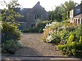
Upper Langridge Farm
A beautiful 300 year old farmhouse sadly demolished in 2011 to be replaced by a so called contemporary structure..........
Image: © Roddy Smith
Taken: 7 Jun 2005
0.03 miles
2
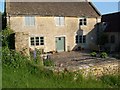
Upper Langridge Farm
Another view of the now demolished 300 year old farmhouse
Image: © Roddy Smith
Taken: 7 Jun 2005
0.05 miles
4
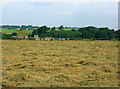
2008 : Hayfield near Upper Langridge Farm
The grass has been cut and turned and is drying off nicely. Will soon be ready for baling.
Image: © Maurice Pullin
Taken: 22 Jul 2008
0.14 miles
5
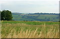
2008 : North east from Lansdown
Charmy Down is to the right on the other side of the Lam Brook valley. beyond that we are looking toward Marshfield.
Image: © Maurice Pullin
Taken: 22 Jul 2008
0.15 miles
6
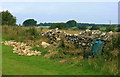
2008 : Drystone wall under repair
Near Upper Langridge Farm.
Building drystone walls is a skilled operation, it is not just a matter of heaping big stones on top of each other. If you find one when out walking please do not try to clamber over, this will certainly damage the wall and may damage you. Look for a suitable crossing place.
Image: © Maurice Pullin
Taken: 22 Jul 2008
0.18 miles
7
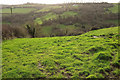
Valley, Upper Langridge
From the other side of a field boundary from Image], so looking more directly across the valley and more directly into the sun, towards Lansdown. Quite near the crest of hill, right of centre, is Upper Langridge Farm.
Image: © Derek Harper
Taken: 7 Dec 2019
0.22 miles