IMAGES TAKEN NEAR TO
Hulk Moor Drove, STREET, BA16 9PA

Introduction

This page details the photographs taken nearby to Hulk Moor Drove, BA16 9PA by members of the Geograph project.

The Geograph project started in 2005 with the aim of publishing, organising and preserving representative images for every square kilometre of Great Britain, Ireland and the Isle of Man.

There are currently over 7.5m images from over14,400 individuals and you can help contribute to the project by visiting https://www.geograph.org.uk

Image Map


Images are licensed for reuse under creativecommons.org/licenses/by-sa/2.0
Notes
  • Clicking on the map will re-center to the selected point.
  • The higher the marker number, the further away the image location is from the centre of the postcode.

Image Listing (37 Images Found)

Images are licensed for reuse under creativecommons.org/licenses/by-sa/2.0
  • ...
Image
Details
Distance
1
View from Pomparles Bridge
The River Brue is nearly at full capacity
Image: © Glyn Baker Taken: 21 Dec 2019
0.06 miles
2
Pomparles Bridge (A39 crossing River Brue)
This shows the original arch and the level deck extension
Image: © David Smith Taken: 16 Nov 2017
0.09 miles
3
River Brue - Pomparles Bridge
Roadside sign at the bridge spanning the River Brue between Glastonbury and Street. Note the historic boundary stone, incised G 1705.
Image: © Colin Smith Taken: 28 Mar 2022
0.09 miles
4
Pomparles Bridge and River Brue
Image: © David Smith Taken: 10 Jun 2017
0.09 miles
5
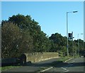
A39 at Pomparles Bridge over River Brue
It is clear that the wall of the bridge has been built in two stages; presumably the closer end is the older.
Image: © David Smith Taken: 28 Sep 2011
0.09 miles
6
Water Meadows and Glastonbury Tor
The River Bure and Mill Stream in flood another Image
Image: © Glyn Baker Taken: 21 Dec 2019
0.10 miles
7
The River Brue at Pomparles Bridge, Glastonbury
Image: © Ken Grainger Taken: 22 May 2009
0.10 miles
8
Milestone by A39 on the edge of Glastonbury
Image: © David Smith Taken: 16 Nov 2017
0.10 miles
9
Glastonbury - Pons Perilis
Archaic name carved on today's Pomparles Bridge which carries the Glastonbury-Street road over the River Brue. The crossing would have been hazardous for medieval and earlier travellers. A pipe bridge also crosses the river here.
Image: © Colin Smith Taken: 28 Mar 2022
0.10 miles
10
Spume on the South Drain
The foam is probably due to the response of algae to fertiliser washed off fields exacerbated the agitation from torrent as the water passed under the A39.
Image: © Glyn Baker Taken: 21 Dec 2019
0.11 miles
  • ...