
IMAGES TAKEN NEAR TO
Lansdown Road, BATH, BA1 5SY
Introduction
This page details the photographs taken nearby to Lansdown Road, BA1 5SY by members of the Geograph project.
The Geograph project started in 2005 with the aim of publishing, organising and preserving representative images for every square kilometre of Great Britain, Ireland and the Isle of Man.

There are currently over 7.5m images from over14,400 individuals and you can help contribute to the project by visiting https://www.geograph.org.uk
Image Map
Images are licensed for reuse under creativecommons.org/licenses/by-sa/2.0
Notes
- Clicking on the map will re-center to the selected point.
- The higher the marker number, the further away the image location is from the centre of the postcode.
Image Listing (74 Images Found)
Images are licensed for reuse under creativecommons.org/licenses/by-sa/2.0
Image
Details
Distance
1
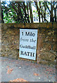
Modern Milepost by Mead House, Lansdown Road, Bath
Replica metal plate by the UC road, in parish of CHARLCOMBE (BATH AND NORTH EAST SOMERSET District), Mead House, Lansdown Road, just South of junction with Northfields, set into stone wall, on East side of road. Bath Guildhall iron plate, originally erected by the Bath turnpike trust in the 18th century.
Inscription reads:-
1 Mile
from the
Guildhall
BATH
Milestone Society National ID: SO_BAWK01.
Image: © Ron Shackell
Taken: Unknown
0.03 miles
2
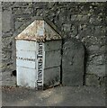
Two Old Boundary Markers beside Lansdown Road, Bath
Two boundary markers set in the pavement and against the stone boundary wall of Innisfree, formerly Mitford House, on the northeast side of Lansdown Road, Bath. See also https://www.geograph.org.uk/photo/7782357.
On the left is a Turnpike Parish Boundary Marker. It is marked CARLCOMBE on the left face, WESTON on the right face, separated by (BA)TH TURNPIKE TRUST vertically with the date 1835 above.
Milestone Society National ID: SO_BAWK00pb
On the right is a Parish Boundary Marker inscribed W P for Weston Parish.
Milestone Society National ID: SO_BAWK03pb
Image: © Roadside Relics
Taken: 5 Jun 2024
0.03 miles
3
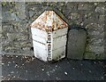
Turnpike Marker & Stone
NE side of Lansdown Road
Image: © Adrian Dust
Taken: 25 May 2024
0.03 miles
4
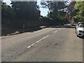
Lansdown Road
Lansdown Road heading past the Turnpike Trust Marker
Image: © Shaun Ferguson
Taken: 5 May 2018
0.03 miles
5
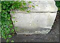
Ordnance Survey Cut Mark
This OS cut mark can be found on the wall post SW side of Lansdown Road. It marks a point 143.261m above mean sea level.
Image: © Adrian Dust
Taken: 25 May 2024
0.03 miles
6
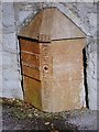
Old Boundary Marker by Lansdown Road, Bath
Parish Boundary Marker - Turnpike by the UC road, in parish of Charlcombe (Bath And North East Somerset District), Mitford House, Landsdown Road, Bath, attached to stone boundary wall, partially buried in pavement.
Inscription reads:- : CARLCOMBE : : (? ?) : : (?)H TURNPIKE TRUST 1835 :
Surveyed
Milestone Society National ID: SO_BAWK00pb.
Image: © Milestone Society
Taken: Unknown
0.04 miles
7
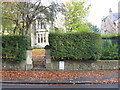
A two-day-old milestone
The metal sign informing passers-by that they are one mile from the Guildhall in Bath was put up two days before this photograph was taken, over a weathered milestone.
Image: © HelenK
Taken: 6 Nov 2010
0.04 miles
8
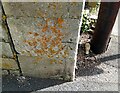
Ordnance Survey Cut Mark
This OS cut mark can be found on the wall at the junction of Lansdown Road & Northfields. It marks a point 148.820m above mean sea level.
Image: © Adrian Dust
Taken: 25 May 2024
0.05 miles
9

Modern detached houses in Northfields Close Lansdown
Image: © Rod Allday
Taken: 4 Mar 2013
0.06 miles
10
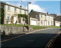
Northfields Close, Bath
Northfields Close is a cul-de-sac on the east side of Lansdown Road.
Image: © Jaggery
Taken: 24 Sep 2011
0.06 miles