
IMAGES TAKEN NEAR TO
Lansdown Grove, BATH, BA1 5EJ
Introduction
This page details the photographs taken nearby to Lansdown Grove, BA1 5EJ by members of the Geograph project.
The Geograph project started in 2005 with the aim of publishing, organising and preserving representative images for every square kilometre of Great Britain, Ireland and the Isle of Man.

There are currently over 7.5m images from over14,400 individuals and you can help contribute to the project by visiting https://www.geograph.org.uk
Image Map
Images are licensed for reuse under creativecommons.org/licenses/by-sa/2.0
Notes
- Clicking on the map will re-center to the selected point.
- The higher the marker number, the further away the image location is from the centre of the postcode.
Image Listing (295 Images Found)
Images are licensed for reuse under creativecommons.org/licenses/by-sa/2.0
Image
Details
Distance
1
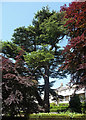
Cedar, Lansdown Grove, Bath
I think it's a cedar, in the grounds of the Lansdown Grove Hotel.
Image: © Stephen Richards
Taken: 25 May 2012
0.04 miles
2
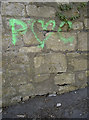
Benchmark
Officially located in Camden Row, not Lovers' Lane. See Image] for a wider view and http://www.bench-marks.org.uk/bm37545 for the Benchmark Database.
Image: © Neil Owen
Taken: 8 Apr 2011
0.06 miles
3
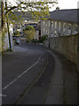
Camden Row, Bath
As is typical of much of residential Bath, access is along a very steep road. See Image] for a benchmark located in this challenging terrain.
Image: © Neil Owen
Taken: 8 Apr 2011
0.06 miles
4
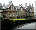
Haygarth Court, Bath
Located in Lansdown Grove, Haygarth Court contains apartments.
Image: © Jaggery
Taken: 24 Sep 2011
0.06 miles
5
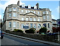
Lansdown Grove Hotel, Bath
On the corner of Lansdown Grove and Lansdown Road.
Image: © Jaggery
Taken: 24 Sep 2011
0.06 miles
6
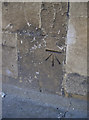
Benchmark, Lansdown Road
A nicely preserved cut mark on the road up to St Stephen's church.
See http://www.bench-marks.org.uk/bm37603 for the Benchmark Database, and Image] for a location view.
Image: © Neil Owen
Taken: 8 Apr 2011
0.06 miles
7
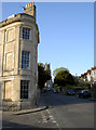
Lansdown Road, Bath
View uphill towards St Stephen's church, close to the junction with Lansdown Crescent.
See Image] for a benchmark cut into the wall, left hand side.
Image: © Neil Owen
Taken: 8 Apr 2011
0.06 miles
8
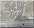
Ordnance Survey Cut Mark
This OS cut mark can be found on No1 Lansdown Place East. It marks a point 108.408m above mean sea level.
Image: © Adrian Dust
Taken: 25 May 2024
0.06 miles
9
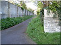
Benchmark, St Stephen's Road
Just down from the church itself, this benchmark is listed in the Database http://www.bench-marks.org.uk/bm37546.
Image: © Neil Owen
Taken: 8 Apr 2011
0.07 miles
10
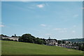
Yet more Georgian architecture
A general view of Bath, taken at the top of what seemed like a steep climb across a golf course, weighted down as I was with a heavy rucksack! To the left of the shot is Cavendish Crescent, completed in the early 1800s and famous as the shortest of Bath's many Georgian crescents at a mere 11 houses.
Image: © John Winder
Taken: 19 Jun 2017
0.08 miles