1
Somerset Place
Part of Somerset Place. Somerset Place was built in two stages, starting in the early 1790s with the central section (the pair of houses in the centre of the photo with the tympanum) by local architect John Eveleigh, with work having to stop due to his bankruptcy. It was later completed in 1820. Parts were damaged by incendiary bombs in the Second World War, but were fully restored. Grade I listed - see http://www.historicengland.org.uk/listing/the-list/list-entry/1394986.
Image: © Ian Capper
Taken: 11 Dec 2015
0.01 miles
2
Somerset Place
Part of Somerset Place viewed from Lansdown Place West. Somerset Place was built in two stages, starting in the early 1790s with the central section (the pair of houses in the centre of the photo with the tympanum) by local architect John Eveleigh, with work having to stop due to his bankruptcy. It was later completed in 1820. Parts were damaged by incendiary bombs in the Second World War, but were fully restored. Grade I listed - see http://www.historicengland.org.uk/listing/the-list/list-entry/1394986.
Image: © Ian Capper
Taken: 11 Dec 2015
0.01 miles
3
Somerset Place, Bath (2)
A grand crescent distinguished by a massive broken segmental pediment containing paterae and swags and topped by a central urn (see also
Image]) . The pediment lends the terrace a slightly old-fashioned air. It is the sort of exuberant but gauche detail a provincial early Georgian builder might have put up. Disturbingly it is off-centre, a product of the building, which began in 1790, being interrupted by a lack of money and only being resumed c1820. John Eveleigh made the designs. Several houses were rebuilt after bomb damage in 1942. Grade I listed.
Visible here are the steps to the raised pavement and a former bracket for a street lamp on the right.
Owned by Bath Spa University until c2005 when the freehold was sold and these are now private houses.
Image: © Stephen Richards
Taken: 25 May 2012
0.01 miles
4
Somerset Place
Part of Somerset Place viewed from Lansdown Place West. Somerset Place was built in two stages, starting in the early 1790s with the central section (the pair of houses in the centre of the photo with the tympanum) by local architect John Eveleigh, with work having to stop due to his bankruptcy. It was later completed in 1820. Parts were damaged by incendiary bombs in the Second World War, but were fully restored. Grade I listed - see http://www.historicengland.org.uk/listing/the-list/list-entry/1394986.
Lansdown Place West, in the foreground, dates from the early 1790s and is by another local architect, John Palmer, but has had subsequent alterations. Grade II listed - see http://www.historicengland.org.uk/listing/the-list/list-entry/1394114.
Image: © Ian Capper
Taken: 11 Dec 2015
0.01 miles
5
Somerset Place, Bath, 1966
Crescent of sixteen terrace houses, 1791-1820 (some restored after World War II bombing). By John Eveleigh. At the time part of Bath College of Domestic Science, it has since been re-converted to residential accommodation. Listed Grade I. For a 21st century comparison, see https://www.geograph.org.uk/photo/3824556
Image: © Alan Murray-Rust
Taken: 18 Jul 1966
0.02 miles
6
Somerset Place, Bath (1)
A grand crescent distinguished by a massive broken segmental pediment containing paterae and swags and topped by a central urn. The pediment lends the terrace a slightly old-fashioned air. It is the sort of exuberant but gauche detail a provincial early Georgian builder might have put up. Disturbingly it is off-centre, a product of the building, which began in 1790, being interrupted by a lack of money and only being resumed c1820. John Eveleigh made the designs. Several houses were rebuilt after bomb damage in 1942. Grade I listed.
Owned by Bath Spa University until c2005 when the freehold was sold and these are now private houses.
Image: © Stephen Richards
Taken: 25 May 2012
0.02 miles
7
Ordnance Survey Cut Mark
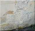
This OS cut mark can be found on the garage south side of Somerset Lane. It marks a point 116.033m above mean sea level.
Image: © Adrian Dust
Taken: 25 May 2024
0.04 miles
8
Winifred's Lane
Narrow leafy lanes such as this can be found in several places near the centre of Bath.
Image: © HelenK
Taken: 6 Jun 2007
0.04 miles
9
Ordnance Survey Cut Mark
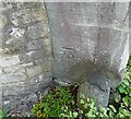
This OS cut mark can be found on the gatepost at the entrance to The Hermitage, Somerset Lane. It marks a point 108.323m above mean sea level.
Image: © Adrian Dust
Taken: 25 May 2024
0.05 miles
10
Mounted on the Wall
"Mounted on the Wall", Winifred's Lane, Lansdowne, Bath
A remnant of an earlier generation of 'public street furniture',
A wall mounted fence brace?
Image: © D M Wilmot
Taken: 15 Apr 2014
0.05 miles


