
IMAGES TAKEN NEAR TO
Manvers Street, TROWBRIDGE, BA14 8YX
Introduction
This page details the photographs taken nearby to Manvers Street, BA14 8YX by members of the Geograph project.
The Geograph project started in 2005 with the aim of publishing, organising and preserving representative images for every square kilometre of Great Britain, Ireland and the Isle of Man.

There are currently over 7.5m images from over14,400 individuals and you can help contribute to the project by visiting https://www.geograph.org.uk
Image Map
Images are licensed for reuse under creativecommons.org/licenses/by-sa/2.0
Notes
- Clicking on the map will re-center to the selected point.
- The higher the marker number, the further away the image location is from the centre of the postcode.
Image Listing (323 Images Found)
Images are licensed for reuse under creativecommons.org/licenses/by-sa/2.0
Image
Details
Distance
1
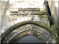
Old school entrance
The entrance by the old sunday school and the United Reformed Church. See Image] for more details.
Image: © Neil Owen
Taken: 26 Nov 2013
0.02 miles
2
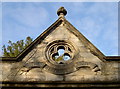
Tabernacle entrance
The modestly ornate stone work over the main entrance to the old Tabernacle church on Church Road. See Image] for a wider view.
Image: © Neil Owen
Taken: 26 Nov 2013
0.02 miles
3
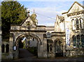
Here it is!
The entrance to the old Tabernacle, along with the row of cottages (see Image]), clearly marked.
Image: © Neil Owen
Taken: 26 Nov 2013
0.02 miles
4
![Trowbridge buildings [12]](https://s1.geograph.org.uk/geophotos/07/43/82/7438205_e629dc82_120x120.jpg)
Trowbridge buildings [12]
In Church Street is this entrance screen to the Tabernacle church complex. Erected in 1871, there is a central and two side gateways in a mixture of styles. Built of ashlar with cast and wrought iron gates. Details of the Church complex are at Image The screen is listed, grade II, with details at: https://historicengland.org.uk/listing/the-list/list-entry/1364248
A market town and county town of Wiltshire, Trowbridge lies on the River Biss, 6 miles (10 kilometres) south of Bath. The town developed as a centre for woollen cloth production from the 14th century, which from the 17th century became increasingly industrialized, so much so that, in 1820, Trowbridge was described as the "Manchester of the West" with over 20 woollen cloth producing factories. The Kennet and Avon Canal runs just to the north of the town and both the Wessex Main Line (Bristol–Westbury–Southampton) and the Heart of Wessex Line (Bristol–Westbury–Weymouth) railways serve the station.
Image: © Michael Dibb
Taken: 14 Feb 2023
0.03 miles
5
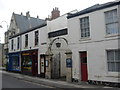
Church Street
Showing entrance to Emmanuel Baptist Church
Image: © Andrew Davis
Taken: 14 Aug 2005
0.03 miles
6
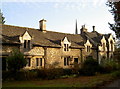
Tabernacle Cottages
This delightful row of cottages has a Tudor feel to them but are in fact rather newer. They were nineteenth century but rebuilt in 1938 by C. Ingham Hadden in loving memory of Rosa Ingham, who passed away on 4th July, 1937.
These cottages were associated with the former Tabernacle church, the Sunday school and a former Women's Institute at the end of the row. Grade II listed. See Image] for the church tower.
Image: © Neil Owen
Taken: 26 Nov 2013
0.03 miles
7
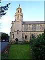
Trowbridge United Church
Viewed from Church Street.
The first church on this site was Tabernacle Congregational Church, formally opened on November 20th 1771. The foundation stone for the current church was laid in 1882, and the church opened in 1884. In 1968, the church was renamed the United Church after the joining of the congregations of the Manvers Street Methodist Church and the Tabernacle Church.
Image: © Jaggery
Taken: 5 Dec 2011
0.03 miles
8
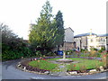
SE corner of Trowbridge United Church grounds
Viewed from Church Street looking towards the church tower. http://www.geograph.org.uk/photo/2759194
Image: © Jaggery
Taken: 5 Dec 2011
0.03 miles
9
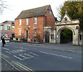
Grade II listed Fernleigh House, Trowbridge
Fernleigh House, 25 Church Street, was built in the 18th century. It is adjacent to the archway entrance to Trowbridge United Church. http://www.geograph.org.uk/photo/2759194 Now used as offices, Fernleigh House was Grade II listed in September 1976.
Image: © Jaggery
Taken: 5 Dec 2011
0.03 miles
10
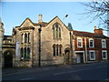
Grade II listed former Tabernacle Sunday School, Trowbridge
The former Sunday School, dating from 1882, is located on Church Street, adjacent to Trowbridge United Church http://www.geograph.org.uk/photo/2759194 (which was built as the Tabernacle Church).
Grade II listed in November 1976.
Image: © Jaggery
Taken: 5 Dec 2011
0.03 miles