
Trowbridge buildings [12]
Introduction
The photograph on this page of Trowbridge buildings [12] by Michael Dibb as part of the Geograph project.
The Geograph project started in 2005 with the aim of publishing, organising and preserving representative images for every square kilometre of Great Britain, Ireland and the Isle of Man.

There are currently over 7.5m images from over 14,400 individuals and you can help contribute to the project by visiting https://www.geograph.org.uk
Trowbridge buildings [12]
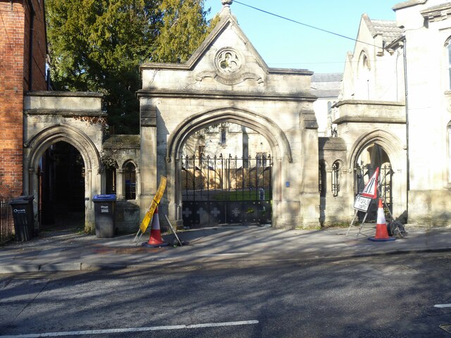
Image: © Michael Dibb Taken: 14 Feb 2023
In Church Street is this entrance screen to the Tabernacle church complex. Erected in 1871, there is a central and two side gateways in a mixture of styles. Built of ashlar with cast and wrought iron gates. Details of the Church complex are at Image The screen is listed, grade II, with details at: https://historicengland.org.uk/listing/the-list/list-entry/1364248 A market town and county town of Wiltshire, Trowbridge lies on the River Biss, 6 miles (10 kilometres) south of Bath. The town developed as a centre for woollen cloth production from the 14th century, which from the 17th century became increasingly industrialized, so much so that, in 1820, Trowbridge was described as the "Manchester of the West" with over 20 woollen cloth producing factories. The Kennet and Avon Canal runs just to the north of the town and both the Wessex Main Line (Bristol–Westbury–Southampton) and the Heart of Wessex Line (Bristol–Westbury–Weymouth) railways serve the station.
Images are licensed for reuse under creativecommons.org/licenses/by-sa/2.0
Image Location

Latitude
51.322258
Longitude
-2.208936