
IMAGES TAKEN NEAR TO
West Street, TROWBRIDGE, BA14 0AH
Introduction
This page details the photographs taken nearby to West Street, BA14 0AH by members of the Geograph project.
The Geograph project started in 2005 with the aim of publishing, organising and preserving representative images for every square kilometre of Great Britain, Ireland and the Isle of Man.

There are currently over 7.5m images from over14,400 individuals and you can help contribute to the project by visiting https://www.geograph.org.uk
Image Map
Images are licensed for reuse under creativecommons.org/licenses/by-sa/2.0
Notes
- Clicking on the map will re-center to the selected point.
- The higher the marker number, the further away the image location is from the centre of the postcode.
Image Listing (124 Images Found)
Images are licensed for reuse under creativecommons.org/licenses/by-sa/2.0
Image
Details
Distance
1

West Street, Trowbridge
Viewed from the Wingfield Road (A366) end. The far end of the street connects with Gloucester Road.
Image: © Jaggery
Taken: 5 Dec 2011
0.03 miles
2
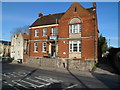
Trowbridge Trades & Labour Club
Located at 24 Stallard Street, facing Gloucester Road. The inscription on the foundation stone is
ESTABLISHED 1914
REBUILT 1924
THIS STONE WAS LAID BY
MRS G WARD
MARCH 15 1924
Image: © Jaggery
Taken: 5 Dec 2011
0.04 miles
3

St. John the Baptist Catholic Church, Trowbridge
Viewed across Wingfield Road. The church dates from 1875. It is built in stone in the Decorated style.
Image: © Jaggery
Taken: 5 Dec 2011
0.06 miles
4
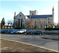
Grade II* listed Holy Trinity church, Trowbridge
The church is located in a rectangular site surrounded by roads - the A363 and A366. Dating from 1837, it is stone-built in the Early English style. Grade II* listed in November 1976.
This view is of the NW side.
Image: © Jaggery
Taken: 5 Dec 2011
0.06 miles
5
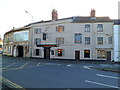
Stallards, Stallard Street, Trowbridge
Located opposite Holy Trinity Church. The pub dates from 1857, originally owned by Ushers Brewery of Trowbridge. The pub is now owned by Frome-based Milk Street Brewery, who renovated the premises which had been vacant for more than two years.
The name on the pub is now Stallards whereas it was previously The Stallards. Stallard may be a variant of stallward, a keeper of horse stalls. Or it may be the name of a resident of Trowbridge who owned several cottages in the area in the distant past.
Image: © Jaggery
Taken: 5 Dec 2011
0.06 miles
6
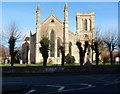
Grade II (Star) listed Holy Trinity church viewed from Stallard Street, Trowbridge
Dating from 1837, the church is stone-built in the Early English style. It was Grade II (Star) listed in 1976. Since the construction of the first part of the Trowbridge Inner Relief Road in the late 1970s, the church site has been encircled by roads. It is often referred to locally as 'the church on the roundabout'.
Image: © Jaggery
Taken: 5 Dec 2011
0.06 miles
7
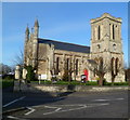
South side of Grade II* listed Holy Trinity Church, Trowbridge
Dating from 1837, the church is stone-built in the Early English style. It was Grade II* listed in November 1976.
Since the construction of the first part of the Trowbridge Inner Relief Road in the late 1970s, the church site has been encircled by roads. It is often referred to locally as 'the church on the roundabout'.
Image: © Jaggery
Taken: 5 Dec 2011
0.06 miles
8
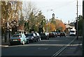
2007 : Wingfield Road, Trowbridge
Situated in one of the more pleasant areas of Trowbridge, St.John's Church is at the town end of Wingfield Road.
Image: © Maurice Pullin
Taken: 6 Nov 2007
0.06 miles

10

Motoring shop on the corner of Newtown and Gloucester Street
This particular premises dates from the early twentieth century and bears a curious motif above the entrance - see Image
Image: © Neil Owen
Taken: 5 Nov 2014
0.07 miles