South side of Grade II* listed Holy Trinity Church, Trowbridge
Introduction
The photograph on this page of South side of Grade II* listed Holy Trinity Church, Trowbridge by Jaggery as part of the Geograph project.
The Geograph project started in 2005 with the aim of publishing, organising and preserving representative images for every square kilometre of Great Britain, Ireland and the Isle of Man.

There are currently over 7.5m images from over 14,400 individuals and you can help contribute to the project by visiting https://www.geograph.org.uk
South side of Grade II* listed Holy Trinity Church, Trowbridge
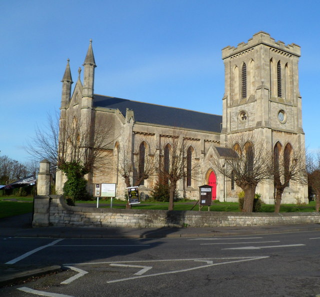
Image: © Jaggery Taken: 5 Dec 2011
Dating from 1837, the church is stone-built in the Early English style. It was Grade II* listed in November 1976. Since the construction of the first part of the Trowbridge Inner Relief Road in the late 1970s, the church site has been encircled by roads. It is often referred to locally as 'the church on the roundabout'.
Images are licensed for reuse under creativecommons.org/licenses/by-sa/2.0
Image Location
Latitude
51.318209
Longitude
-2.215188