
IMAGES TAKEN NEAR TO
Locksbrook Place, BATH, BA1 3DG
Introduction
This page details the photographs taken nearby to Locksbrook Place, BA1 3DG by members of the Geograph project.
The Geograph project started in 2005 with the aim of publishing, organising and preserving representative images for every square kilometre of Great Britain, Ireland and the Isle of Man.

There are currently over 7.5m images from over14,400 individuals and you can help contribute to the project by visiting https://www.geograph.org.uk
Image Map
Images are licensed for reuse under creativecommons.org/licenses/by-sa/2.0
Notes
- Clicking on the map will re-center to the selected point.
- The higher the marker number, the further away the image location is from the centre of the postcode.
Image Listing (99 Images Found)
Images are licensed for reuse under creativecommons.org/licenses/by-sa/2.0
Image
Details
Distance
1
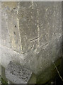
Benchmark in Locksbrook Place
A cut mark (as described in the Benchmark Database: http://www.bench-marks.org.uk/bm40832 ) on a corner facing onto the Upper Bristol Road.
Image: © Neil Owen
Taken: 6 Jan 2012
0.01 miles
2
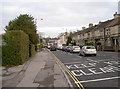
Upper Bristol Road, Bath
Looking east towards the city centre this road once had a pub (the Windsor Castle Inn) and a petrol station; they are no longer in business. A benchmark can be found near this spot: Image
Image: © Neil Owen
Taken: 6 Jan 2012
0.02 miles
3
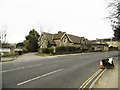
Lower Weston, disused school
On Upper Bristol Road; according to signage, now an educational depot.
Image: © Mike Faherty
Taken: 8 Mar 2015
0.03 miles
4
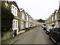
Lower Weston, Hungerford Road
A pleasant road of stone terraced houses.
Image: © Mike Faherty
Taken: 8 Mar 2015
0.03 miles
5
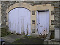
Peeling archway
The inclusion of an otherwise unconnected arch and door among the houses in a typical Edwardian terrace seems rather odd. Despite that, its many paint layers are now becoming in danger of crumbling. A benchmark has been cut into the stonework; see http://www.bench-marks.org.uk/bm40834 for the Benchmark Database, and Image] for a closer view of it.
Image: © Neil Owen
Taken: 6 Jan 2012
0.04 miles
6
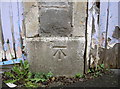
Benchmark on the archway
A fine cutmark (as listed in the Benchmark Database http://www.bench-marks.org.uk/bm40834 ) on an unusual feature. Hungerford Road appears a normal Edwardian terrace in Bath, but halfway along it is this small arch and side door. See Image] for a fuller view.
Image: © Neil Owen
Taken: 6 Jan 2012
0.04 miles
7
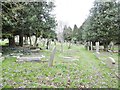
Lower Weston, Locksbrook Cemetery
Maintained by the City of Bath; closed since 1937: http://www.bathnes.gov.uk/services/births-marriages-and-deaths/burials-and-cremations/cemeteries/locksbrook-cemetery
Image: © Mike Faherty
Taken: 8 Mar 2015
0.05 miles
8
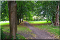
Bath : Footpath
A footpath heads towards Windsor Villas.
Image: © Lewis Clarke
Taken: 6 Aug 2020
0.07 miles
9
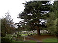
Resting in a peaceful place
Some of the variety of foliage in Locksbrook Cemetery.
Image: © Neil Owen
Taken: 6 Jan 2012
0.07 miles
10
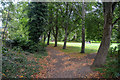
Bath : Footpath
A footpath heads to Windsor Villas.
Image: © Lewis Clarke
Taken: 6 Aug 2020
0.07 miles