1
Storridge Road houses near Westbury
Viewed from near crossroads beyond Westbury's NW boundary sign.
Image: © Jaggery
Taken: 8 Mar 2014
0.02 miles
2
ULN (UK) Ltd in Westbury
Packers and wrappers of French cheeses, located in The Ham, Brook Lane, Westbury.
Image: © Jaggery
Taken: 8 Mar 2014
0.03 miles
3
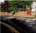
Red phonebox, Brook Lane, Westbury
On the corner of Storridge Road.
Image: © Jaggery
Taken: 15 Sep 2018
0.04 miles
4
Spar at crossroads NW of Westbury
Located in The Ham at the junction of Station Road, Brook Lane, Storridge Road and The Ham.
The sign pointing right along the B3097 The Ham shows Hawkeridge, Chippenham, Warminster, Frome.
The post office sign seen in this http://www.geograph.org.uk/photo/818525 view from 2008 has gone.
Image: © Jaggery
Taken: 8 Mar 2014
0.04 miles
5
Shop and post office, The Ham, Westbury
Image: © Roger Cornfoot
Taken: 12 Aug 2019
0.04 miles
6
2008 : Crossroads and Post Office at The Ham, Westbury
Westbury town centre is about a mile along the road to the left.
Image: © Maurice Pullin
Taken: 19 May 2008
0.05 miles
7
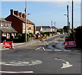
Road Ahead Closed, The Ham near Westbury
The white on red signs are at the southwest end of the B3097 The Ham on September 15th 2018.
Image: © Jaggery
Taken: 15 Sep 2018
0.05 miles
8
Ham Stores and post office near Westbury
A post office counter is inside Ham Stores located at the junction of Station Road, Brook Lane, Storridge Road and The Ham. In September 2018 Ham Stores is a Premier convenience store. It was a Spar in March 2014. https://www.geograph.org.uk/photo/3879406
Image: © Jaggery
Taken: 15 Sep 2018
0.05 miles
9
Queen Elizabeth II pillarbox outside Ham Stores and post office near Westbury
Located here. https://www.geograph.org.uk/photo/5911303
Image: © Jaggery
Taken: 15 Sep 2018
0.05 miles
10
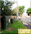
Station Road telecoms cabinets, Westbury
At the NW end of Station Road near the corner of Brook Lane.
Image: © Jaggery
Taken: 15 Sep 2018
0.06 miles


