IMAGES TAKEN NEAR TO
Blackett Lane, WESTBURY, BA13 4FT

Introduction

This page details the photographs taken nearby to Blackett Lane, BA13 4FT by members of the Geograph project.

The Geograph project started in 2005 with the aim of publishing, organising and preserving representative images for every square kilometre of Great Britain, Ireland and the Isle of Man.

There are currently over 7.5m images from over14,400 individuals and you can help contribute to the project by visiting https://www.geograph.org.uk

Image Map


Images are licensed for reuse under creativecommons.org/licenses/by-sa/2.0
Notes
  • Clicking on the map will re-center to the selected point.
  • The higher the marker number, the further away the image location is from the centre of the postcode.

Image Listing (139 Images Found)

Images are licensed for reuse under creativecommons.org/licenses/by-sa/2.0
  • ...
Image
Details
Distance
1
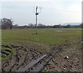
Muddy field near Oldfield Road, Westbury
Viewed from a track, a SW continuation of Station Approach.
Image: © Jaggery Taken: 8 Mar 2014
0.04 miles
2
Electricity substation at the edge of railway sidings in Westbury
To the south of Westbury railway station.
Image: © Jaggery Taken: 8 Mar 2014
0.05 miles
3
DB Schenker sidings
At Station Approach, Westbury.
Image: © Peter Holmes Taken: 7 Dec 2013
0.05 miles
4
Railway siding and buildings in Westbury
Part of an area of sidings near Westbury railway station.
Image: © Jaggery Taken: 8 Mar 2014
0.05 miles
5
Route to Westbury Station
Track linking footpath West15 with Westbury Station.
Image: © Peter Holmes Taken: 7 Dec 2013
0.06 miles
6
Path to Oldfield Road
Public footpath West15 crossing field. The Westbury White Horse can be viewed in the distance, located on the edge of Bratton Downs on the escarpment of Salisbury Plain.
Image: © Peter Holmes Taken: 7 Dec 2013
0.07 miles
7
Westbury sidings
Image: © N Chadwick Taken: 23 Sep 2018
0.08 miles
8
Westbury railway station [2]
A long line of stone wagons on a siding. The railway station in Westbury, Wiltshire, is a major junction. It serves (a) the Reading to Taunton line with services to and from Penzance and London Paddington; (b) the Wessex Main Line with services to and from Cardiff and Portsmouth, and to and from Swindon; (c) the Heart of Wessex Line with local services from Bristol Temple Meads to Weymouth; (d) services to London Waterloo. A large freight yard adjacent to the station is used by bulk limestone trains from the rail-served quarries at Merehead and Whatley in Somerset.
Image: © Michael Dibb Taken: 28 Jul 2022
0.08 miles
9
Freight trains, Westbury Sidings
Image: © N Chadwick Taken: 23 Sep 2018
0.09 miles
10
Path to Penleigh Farm
Public footpath West15.
Image: © Peter Holmes Taken: 7 Dec 2013
0.09 miles
  • ...