
IMAGES TAKEN NEAR TO
Shawford, FROME, BA11 6SQ
Introduction
This page details the photographs taken nearby to Shawford, BA11 6SQ by members of the Geograph project.
The Geograph project started in 2005 with the aim of publishing, organising and preserving representative images for every square kilometre of Great Britain, Ireland and the Isle of Man.

There are currently over 7.5m images from over14,400 individuals and you can help contribute to the project by visiting https://www.geograph.org.uk
Image Map
Images are licensed for reuse under creativecommons.org/licenses/by-sa/2.0
Notes
- Clicking on the map will re-center to the selected point.
- The higher the marker number, the further away the image location is from the centre of the postcode.
Image Listing (16 Images Found)
Images are licensed for reuse under creativecommons.org/licenses/by-sa/2.0
Image
Details
Distance
1
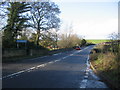
Bridge over the River Frome
A view looking to the northwest along the A36 as it crosses the River Frome. The old toll gate can be seen in the background.
Image: © Phil Williams
Taken: 26 Nov 2006
0.04 miles
2
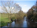
River Frome near Woolverton
A view looking to the northeast along the River Frome, swollen after recent heavy rain, taken from the parapet of the bridge on the A36.
Image: © Phil Williams
Taken: 26 Nov 2006
0.04 miles
3
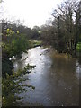
River Frome
A view looking to the south west (upstream) along the River Frome, swollen after recent heavy rain.
Image: © Phil Williams
Taken: 26 Nov 2006
0.04 miles
4
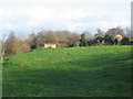
Pillbox near Woolverton
A view looking east over farmland towards a pillbox overlooking the River Frome near Woolverton. The rooftops of Merfield House can be seen in the background at centre right.
Image: © Phil Williams
Taken: 26 Nov 2006
0.04 miles
5

Shawford Bridge stone
A marker stone on the southeast side of the Frome.
Image: © Neil Owen
Taken: 11 Jun 2025
0.05 miles
6

The Frome and its leat
Here at Shawford Bridge, the River Frome is reunited with its diverted leat. In the past, the leat was used by Shawford mill to work the cloth and dye works.
Image: © Neil Owen
Taken: 11 Jun 2025
0.05 miles
7
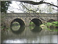
Bridge on the A36 across the River Frome
Image: © Dr Duncan Pepper
Taken: 6 Apr 2009
0.07 miles
8

The Frome under Shawford Bridge
Flowing northeastwards to Bath.
Image: © Neil Owen
Taken: 11 Jun 2025
0.07 miles
9

Bridge stone
Shawford Bridge has two marker stones at either end, noting (if weathered) the construction of circa 1752?
Image: © Neil Owen
Taken: 11 Jun 2025
0.07 miles
10
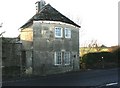
2007 : Turnpike Toll House
Now on the A36 Bath to Warminster road, this toll house once belonged to the Turnpike Trust. http://en.wikipedia.org/wiki/Turnpike_Trusts
Image: © Maurice Pullin
Taken: 17 Dec 2007
0.09 miles