
IMAGES TAKEN NEAR TO
Bath Road, FROME, BA11 6SH
Introduction
This page details the photographs taken nearby to Bath Road, BA11 6SH by members of the Geograph project.
The Geograph project started in 2005 with the aim of publishing, organising and preserving representative images for every square kilometre of Great Britain, Ireland and the Isle of Man.

There are currently over 7.5m images from over14,400 individuals and you can help contribute to the project by visiting https://www.geograph.org.uk
Image Map
Images are licensed for reuse under creativecommons.org/licenses/by-sa/2.0
Notes
- Clicking on the map will re-center to the selected point.
- The higher the marker number, the further away the image location is from the centre of the postcode.
Image Listing (22 Images Found)
Images are licensed for reuse under creativecommons.org/licenses/by-sa/2.0
Image
Details
Distance
1
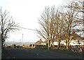
2007 : Road to nowhere
Formerly the main road between Beckington and Bath it has been superseded by the great bypass and now stops short of the new road.
Image: © Maurice Pullin
Taken: 17 Dec 2007
0.01 miles
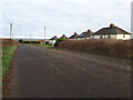
3
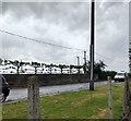
Espalier hedge by the old road to Shawford
Opposite the memorial hall an espalier hedge has been planted. The trees are now set enough that their training support has been removed, but their foliage has not yet grown. The road was surprisingly busy when this photograph was taken.
Image: © HelenK
Taken: 10 Jun 2019
0.07 miles
4
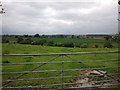
Looking west across the Frome River valley, north of Beckington
Image: © Rob Purvis
Taken: 8 Jun 2012
0.07 miles
5
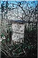
Old Milestone, Forrmer A36, Bath Road, North of Beckington
The milestone is located near Clifford Farm, on the rough bank, on the east side of the road. Parish of Beckington (Mendip District). Cast iron post, C&M Classical iron casting design, erected by the Black Dog turnpike trust in the 19th century.
Inscription reads:-
BATH /10 / WARMINSTER 7 / FROME / 3
Grade II listed, List Entry Number: 1345295 https://historicengland.org.uk/listing/the-list/list-entry/1345295
Milestone Society National ID: SO_BAWM10
Image: © Janet Dowding
Taken: 6 Feb 2008
0.07 miles
6
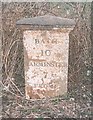
Old Milestone, Forrmer A36, Bath Road, North of Beckington
The milestone is located near Clifford Farm, on the rough bank, on the east side of the road. Parish of Beckington (Mendip District). Cast iron post, C&M Classical iron casting design, erected by the Black Dog turnpike trust in the 19th century. Photograph date is not known but before this later photograph of the milestone https://www.geograph.org.uk/photo/7442989
Inscription reads:-
BATH /10 / WARMINSTER 7 / FROME / 3
Grade II listed, List Entry Number: 1345295 https://historicengland.org.uk/listing/the-list/list-entry/1345295
Milestone Society National ID: SO_BAWM10
Image: © Milestone Society
Taken: 1 Jan 1900
0.07 miles
7
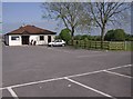
Beckington Memorial Hall
It's the first Thursday in May, so the hall is being used as a Polling Station. 11:45 and lots of democracy in action.
Image: © Graham Horn
Taken: 3 May 2007
0.10 miles
8
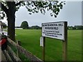
Beckington Recreation Field
A corner of the Memorial Hall is just visible on the left. "The Village Hall was created out of money raised by the people of Beckington, following the world wars, as a Memorial to those local people who lost their lives for the country." http://www.beckington.org.uk/amenities/memorialhall.htm#history
The ground is used by Beckington Cricket Club http://www.beckingtoncricketclub.co.uk/history.php .
But keep your dog on its leash, and do remember to take faeces away with you.
Image: © HelenK
Taken: 10 Jun 2019
0.10 miles
9
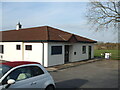
Beckington Memorial Hall
The village raised the money to build a hall as a memorial to those lost during both world wars. It has been extended several times in recent decades.
Image: © Neil Owen
Taken: 22 Mar 2021
0.11 miles
