
IMAGES TAKEN NEAR TO
The Mead, FROME, BA11 6PF
Introduction
This page details the photographs taken nearby to The Mead, BA11 6PF by members of the Geograph project.
The Geograph project started in 2005 with the aim of publishing, organising and preserving representative images for every square kilometre of Great Britain, Ireland and the Isle of Man.

There are currently over 7.5m images from over14,400 individuals and you can help contribute to the project by visiting https://www.geograph.org.uk
Image Map
Images are licensed for reuse under creativecommons.org/licenses/by-sa/2.0
Notes
- Clicking on the map will re-center to the selected point.
- The higher the marker number, the further away the image location is from the centre of the postcode.
Image Listing (67 Images Found)
Images are licensed for reuse under creativecommons.org/licenses/by-sa/2.0
Image
Details
Distance
2

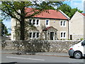
Rode school
The school is the Rode Methodist VC First School, and appears to have been founded at the end of the nineteenth century. Note the separate entrances for boys and girls.
Image: © Neil Owen
Taken: 4 Nov 2016
0.09 miles
3
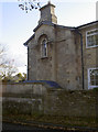
Merfield House
A local millowner, Jonathan Noad, had the house built in 1804. A benchmark can be located on the pier by the road - see Image
Image: © Neil Owen
Taken: 7 Nov 2016
0.09 miles
4
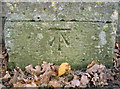
Benchmark on Rockabella Hill
A cutmark, as listed in the benchmark Database: http://www.bench-marks.org.uk/bm80276 , outside Merfield House - see Image] for a wider view.
Image: © Neil Owen
Taken: 7 Nov 2016
0.09 miles
5
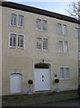
Mayfield Mill
Formerly a working mill, now a private residence.
Image: © Neil Owen
Taken: 7 Nov 2016
0.09 miles
7
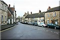
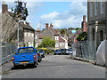
2008 : High Street, Rode
High Street heads off in front, on its way to Beckington about 2 miles off.
This is pretty well the heart of the village, the Cross Keys is a few yards down to the left, Lower Street joins on the right a little further on.
The brewery of H.H.& S. Fussell was behind the buildings immediately in front on the left, the main entrance, a few yards out of the frame to the left is now built over. It was taken over by Bass Mitchells & Butlers in the early 1960's.
Image: © Maurice Pullin
Taken: 5 Jan 2008
0.10 miles
8
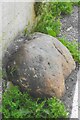
Old Boundary Marker on Lower Street, Rode
County Boundary Marker set in the road on Lower Street against the western corner of The Corner House, 21 High Street, a stone building at the junction of Lower Street and High Street. Until 1937 this was on the boundary of Rode, Somerset and Southwick, Wiltshire but is now entirely in Rode parish.
Milestone Society National ID: SO_RODE02cb
Image: © R Raynsford
Taken: 5 Jul 2021
0.10 miles
9
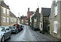
2008 : High Street, Rode (2)
Entering Rode from the south west and looking along High Street a prominent feature is the red brick maltings of the former brewery of H.H.& S. Fussells, a major industry in the village following the collapse of the wool trade.
Image: © Maurice Pullin
Taken: 5 Jan 2008
0.10 miles
10
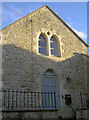
The old Silcocks Hall
A local benefactor, Edward Silcocks, built this small hall for the free use of the villagers in 1868. Today it is a private residence.
Image: © Neil Owen
Taken: 4 Nov 2016
0.10 miles