
IMAGES TAKEN NEAR TO
Wesley Slope, FROME, BA11 1HA
Introduction
This page details the photographs taken nearby to Wesley Slope, BA11 1HA by members of the Geograph project.
The Geograph project started in 2005 with the aim of publishing, organising and preserving representative images for every square kilometre of Great Britain, Ireland and the Isle of Man.

There are currently over 7.5m images from over14,400 individuals and you can help contribute to the project by visiting https://www.geograph.org.uk
Image Map
Images are licensed for reuse under creativecommons.org/licenses/by-sa/2.0
Notes
- Clicking on the map will re-center to the selected point.
- The higher the marker number, the further away the image location is from the centre of the postcode.
Image Listing (326 Images Found)
Images are licensed for reuse under creativecommons.org/licenses/by-sa/2.0
Image
Details
Distance
1
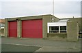
Frome Fire Station
Frome Fire Station, Keyford, Frome, Somerset.
Image: © Kevin Hale
Taken: 25 Apr 1993
0.03 miles
2
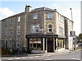
The Cornerhouse
An old pub on a busy junction in Frome, the Cornerhouse is a new venture started in February 2011. Before that it was the Lamb Inn for many years. During the growing tensions surrounding the First World War it was used as a drill hall. See http://www.geograph.org.uk/article/WW1-Great-War-Centenary---Drill-Halls/9#somerset.
Image: © Neil Owen
Taken: 7 Oct 2014
0.04 miles
3
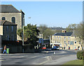
2010 : B3090 Wesley Slope, Frome
At the bottom of Wesley Slope the B3090 crosses the A362 and passes down Bath Street.
This image was taken at the end of the B3092 from Maiden Bradley.
The distant fields emphasise the fact that Frome is a small and friendly town with very little in the way urban sprawl.
Image: © Maurice Pullin
Taken: 8 Mar 2010
0.04 miles
4
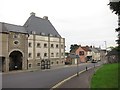
Maltings, Christchurch Street East
Image: © Oast House Archive
Taken: 23 Aug 2013
0.04 miles
5
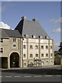
When beer was king
Frome has a lot of brewing history, much of which came to a fairly abrupt end after the mergers and takeovers post-war. This lofty building has retained some of the original features of the industry. Indeed, the picture was taken from the traffic island where there was once a larger brewery, but is now cleared.
Image: © Neil Owen
Taken: 7 Oct 2014
0.04 miles
6
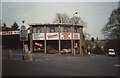
Top of Bath Street, Frome
Tonemar don't understand how to use apostrophes!
Image: © David Doff
Taken: Unknown
0.04 miles
7
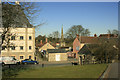
2010 : View across the green to Gentle Street
Christchurch Street and the A362 runs along the other side of the open space.
Frome caters for many needs, from right to left we have the public toilets trying to hide behind a tree, the spire of the Church of St. John the Baptist, then, on the other side of Gentle Street, the large modern looking building is an old brewery, not sure which one. Frome was well blessed for breweries before 1950 then came the great mergers and takeovers, the 1950's and 60's were "interesting times" for anyone in the brewing industry.
Image: © Maurice Pullin
Taken: 8 Mar 2010
0.06 miles
8
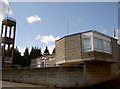
Frome fire station
This relatively modern station (c.1970) stands on what used to be the Unicorn public house in Keyford.
Image: © Neil Owen
Taken: 7 Oct 2014
0.06 miles
9
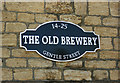
2010 : Sign at the top of Gentle Street, Frome
Not sure which old brewery this sign refers to, there were a number in Frome before 1950. Information would be welcome if anyone can help.
The premises now appear to be empty.
The building in question appears in Image]
Image: © Maurice Pullin
Taken: 8 Mar 2010
0.08 miles
10

House on Gentle Street
Door and window on a house on Gentle Street.
Image: © Philip Halling
Taken: 17 Jul 2025
0.08 miles