IMAGES TAKEN NEAR TO
Ashford Lane, SOLIHULL, B94 6RH
Introduction
This page details the photographs taken nearby to Ashford Lane, B94 6RH by members of the Geograph project.
The Geograph project started in 2005 with the aim of publishing, organising and preserving representative images for every square kilometre of Great Britain, Ireland and the Isle of Man.

There are currently over 7.5m images from over14,400 individuals and you can help contribute to the project by visiting https://www.geograph.org.uk
Image Map
Images are licensed for reuse under creativecommons.org/licenses/by-sa/2.0
Notes
- Clicking on the map will re-center to the selected point.
- The higher the marker number, the further away the image location is from the centre of the postcode.
Image Listing (38 Images Found)
Images are licensed for reuse under creativecommons.org/licenses/by-sa/2.0
Image
Details
Distance
1
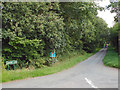
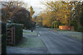
Northeast on Ashford Lane, north of School Road
In the distance is a red car beyond two people walking dogs.
Image: © Robin Stott
Taken: 31 Aug 2013
0.08 miles
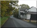
2
School Road on the west side of Hockley Heath
Image: © Richard Law
Taken: 4 Mar 2020
0.13 miles
4
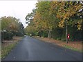
School Road, west of Sadlerswell Lane
Image: © Peter Whatley
Taken: 12 Nov 2011
0.14 miles
5
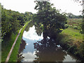
Southeast on the Stratford-upon-Avon Canal from Bridge 23
Compare the land on the right with http://www.geograph.org.uk/photo/86446
The neighbouring field is seen in http://www.geograph.org.uk/photo/3760745
Image: © Robin Stott
Taken: 31 Aug 2013
0.14 miles
8
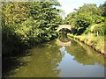
Stratford-on-Avon Canal: Bridge Number 23: Ashford Lane Bridge
Following in Roger's footsteps again Image and, totally coincidentally, exactly four years to the day afterwards, here is the Ashford Lane bridge again. The parapet coping brickwork, notably missing in the 2008 image, appears to have been replaced.
Image: © Nigel Cox
Taken: 7 Sep 2012
0.15 miles
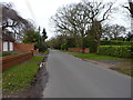
9
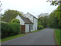
School Road, Hockley Heath
Leading north west from Hockley Heath village, School Road is lined by large houses. It would appear to be bin day in this view.
Image: © Stephen McKay
Taken: 30 Dec 2014
0.15 miles
10
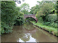
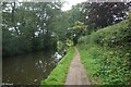
Stratford-upon-Avon Canal near Hockley Heath, Solihull
This is approaching Bridge No 23, which carries a wide rough track with public access linking lanes each side of the canal.
The Stratford-upon-Avon Canal was built from King's Norton Junction (with the Worcester and Birmingham Canal) to Kingswood Junction (with the Warwick and Birmingham Canal - now Grand Union Canal) by 1803. A second phase of construction started in 1812, and by 1815 was connected to the River Avon in Stratford. Total length 25.5 miles, with 54 locks.
Image: © Roger D Kidd
Taken: 7 Sep 2008
0.15 miles