Stratford-upon-Avon Canal near Hockley Heath, Solihull
Introduction
The photograph on this page of Stratford-upon-Avon Canal near Hockley Heath, Solihull by Roger D Kidd as part of the Geograph project.
The Geograph project started in 2005 with the aim of publishing, organising and preserving representative images for every square kilometre of Great Britain, Ireland and the Isle of Man.

There are currently over 7.5m images from over 14,400 individuals and you can help contribute to the project by visiting https://www.geograph.org.uk
Stratford-upon-Avon Canal near Hockley Heath, Solihull
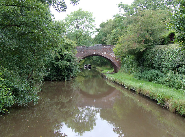
Image: © Roger D Kidd Taken: 7 Sep 2008
This is approaching Bridge No 23, which carries a wide rough track with public access linking lanes each side of the canal. The Stratford-upon-Avon Canal was built from King's Norton Junction (with the Worcester and Birmingham Canal) to Kingswood Junction (with the Warwick and Birmingham Canal - now Grand Union Canal) by 1803. A second phase of construction started in 1812, and by 1815 was connected to the River Avon in Stratford. Total length 25.5 miles, with 54 locks.
Images are licensed for reuse under creativecommons.org/licenses/by-sa/2.0
Image Location
Latitude
52.356182
Longitude
-1.790606