1
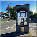
Reddicap Heath crossroads
Junction of Reddicap Heath Road and Hollyfield Road, opposite shops and car parking
Image: © Graham Flint
Taken: 1 Nov 2006
0.05 miles
2
Crossroads, Reddicap Heath
Reddicap Heath Road, foreground and ahead, crosses Hollyfield Road B4148. There are shops and services around the junction.
Image: © Robin Stott
Taken: 18 Oct 2022
0.05 miles
3
Rectory Park Avenue, Sutton Coldfield
Image: © Robin Stott
Taken: 18 Oct 2022
0.07 miles
4
Shops, Reddicap Heath
The shops and services in shot on Hollyfield Road South include a bookmaker, hair salon, vape shop, Subway, fish and chips, car servicing and Co-op Food.
Image: © Robin Stott
Taken: 18 Oct 2022
0.07 miles
5
North end of Walmley Road, Sutton Coldfield
Walmley Road runs south for over three kilometres towards Pype Hayes.
Image: © Robin Stott
Taken: 18 Oct 2022
0.07 miles
6
Restaurant, Reddicap Heath
Opposite the shops on Hollyfield Road South "Great Italian Food" from Pesto occupies a former pub, The Bowling Green.
Image: © Robin Stott
Taken: 18 Oct 2022
0.08 miles
7
BT phone kiosk, Reddicap Heath
It's by Hollyfield Road South near the shops. Calls may be paid for by cash or card.
Image: © Robin Stott
Taken: 18 Oct 2022
0.08 miles
8
North end of Walmley Road, Sutton Coldfield
Big detached houses sit in big gardens behind a broad strip of mature trees – a scrap of woodland once, perhaps, but too random for a hedgerow. Old maps show a strip of trees called The Belt along the road northeast of New Hall, so perhaps it marked the boundary of that estate.
Image: © Robin Stott
Taken: 19 Oct 2022
0.08 miles
9
Mount View, Sutton Coldfield
At the top of Reddicap Hill, Mount View is the access to two blocks of flats, out of shot left
Image In view are what look very like local authority bungalows for old people.
Image: © Robin Stott
Taken: 18 Oct 2022
0.09 miles
10
Mount View Sutton Coldfield
Image: © Roy Hughes
Taken: 7 Feb 2018
0.09 miles


