
IMAGES TAKEN NEAR TO
Bristol Road South, BIRMINGHAM, B45 9PG
Introduction
This page details the photographs taken nearby to Bristol Road South, B45 9PG by members of the Geograph project.
The Geograph project started in 2005 with the aim of publishing, organising and preserving representative images for every square kilometre of Great Britain, Ireland and the Isle of Man.

There are currently over 7.5m images from over14,400 individuals and you can help contribute to the project by visiting https://www.geograph.org.uk
Image Map
Images are licensed for reuse under creativecommons.org/licenses/by-sa/2.0
Notes
- Clicking on the map will re-center to the selected point.
- The higher the marker number, the further away the image location is from the centre of the postcode.
Image Listing (33 Images Found)
Images are licensed for reuse under creativecommons.org/licenses/by-sa/2.0
Image
Details
Distance
1
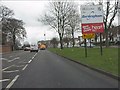
Welcome to Birmingham on the northbound A38
The actual boundary is acouple of hundred yards west of the sign. Ahead are the traffic lights for Park Way.
Image: © Peter Whatley
Taken: 10 Mar 2012
0.03 miles
2
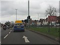
Say please
Possibly only in the UK would a sign indicating prohibited activity say "please". Photographed at the intersection of Bristol Road South (A38) and Park Way.
Image: © Peter Whatley
Taken: 10 Mar 2012
0.04 miles
3
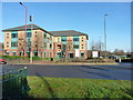
Office block on Bristol Road South
Currently owned and operated by Regus, who I believe are providers of short-term and temporary office accommodation.
Image: © Richard Law
Taken: 20 Jan 2020
0.04 miles
4
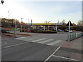
Morrison's petrol at Rubery Great Park
For a close up see Image
Image: © Jeff Gogarty
Taken: 14 Mar 2016
0.09 miles
6
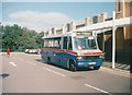
Bus at Safeway superstore, Rubery (2)
Travel West Midlands 719, a Mercedes-Benz 709D with bodywork built locally by Carlyle, lays over in the car park of the former Safeway superstore in Rubery, between journeys on the 647. If memory serves, the other end of this route was somewhere in Harborne (Moor Pool rings a bell somewhere), and it served various odd roads that were not on main bus routes. In common with many, this Safeway store became a Morrisons in 2005.
Image: © Richard Vince
Taken: Unknown
0.10 miles
7
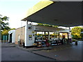
Morrisons petrol kiosk, Birmingham Great Park, Rubery
Image: © Jeff Gogarty
Taken: 30 Sep 2015
0.10 miles
8
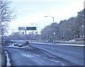
Start of the A38 Rubery Flyover.
The Rubery by-pass heading South towards the M5 Motorway Junction 4
Image: © Roy Hughes
Taken: 4 Feb 2009
0.11 miles

10
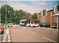
Bus at Safeway superstore, Rubery (1)
Travel West Midlands 518, a Volvo B6LE/Wright Crusader then less than a year old, proceeds slowly through the car park of the former Safeway superstore in Rubery, working route 49A from Northfield via Frankley. The 49A was a shorter, more frequent (every 12 minutes if memory serves) variation of the enormously long 49, which went all the way from Northfield to Solihull; in contrast, the 49A just shuttled between Northfield and Rubery Safeway, via a different route in Frankley. In common with many, this Safeway store became a Morrisons in 2005.
Image: © Richard Vince
Taken: Unknown
0.11 miles