
IMAGES TAKEN NEAR TO
Kingsbury Road, BIRMINGHAM, B24 8RB
Introduction
This page details the photographs taken nearby to Kingsbury Road, B24 8RB by members of the Geograph project.
The Geograph project started in 2005 with the aim of publishing, organising and preserving representative images for every square kilometre of Great Britain, Ireland and the Isle of Man.

There are currently over 7.5m images from over14,400 individuals and you can help contribute to the project by visiting https://www.geograph.org.uk
Image Map
Images are licensed for reuse under creativecommons.org/licenses/by-sa/2.0
Notes
- Clicking on the map will re-center to the selected point.
- The higher the marker number, the further away the image location is from the centre of the postcode.
Image Listing (14 Images Found)
Images are licensed for reuse under creativecommons.org/licenses/by-sa/2.0
Image
Details
Distance
1
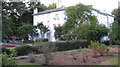
Rookery House, Erdington
Awaiting restoration it seems, but with idyllic gardens, and access (on left of photo) into Rookery Park
http://www.rookery-house.co.uk/index.htm
Image: © Michael Westley
Taken: 10 Aug 2010
0.05 miles
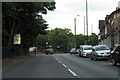
3
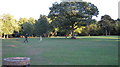
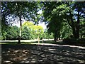
Looking across Rookery Park
A Summer's evening walk around the park, situated on Outer Ring Road, near Erdington
Image: © Michael Westley
Taken: 10 Aug 2010
0.09 miles
4
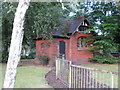
Former public toilets, Rookery Park
Boarded up toilets in corner of Rookery Park, facing Wood End Road
Image: © Michael Westley
Taken: 10 Aug 2010
0.09 miles
5
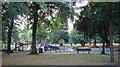
Rookery Park, Play Area
Wonderful resource, and well used by local families
Image: © Michael Westley
Taken: 10 Aug 2010
0.11 miles
7
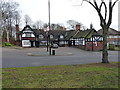
The Lad in the Lane public house
A remarkable survivor of the middle ages - parts of this Grade II listed building date back to the 14th & 15th centuries, and there has been an inn on the site since 1306. http://www.britishlistedbuildings.co.uk/en-216828-the-lad-in-the-lane-public-house-#.WMED82-LSM8
Image: © Richard Law
Taken: 28 Feb 2017
0.14 miles
8
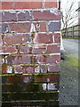
OS benchmark - Birches Green, Lad in the Lane
An OS cutmark on the wall of the pub that is now the Lad in the Lane, but was formerly the Green Man; originally levelled at 113.18m above Ordnance Datum Newlyn.
Image: © Richard Law
Taken: 28 Feb 2017
0.14 miles
9
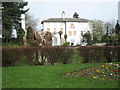
Rookery House and Gardens
Not yet open to public, in need of restoration http://www.rookery-house.co.uk/index.htm
Image: © Michael Westley
Taken: 27 Mar 2011
0.15 miles
10
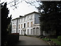
Rookery House, Erdington
Another historic house awaiting funding for restoration, alongside popular park south of Erdington, and with well-kept and quiet gardens. House not open to public - but interesting website - http://www.rookery-house.co.uk
Image: © Michael Westley
Taken: 27 Mar 2011
0.18 miles