1
Church Lane, Handsworth
Image: © Peter Whatley
Taken: 2 Oct 2008
0.12 miles
2
House on Church Lane, Handsworth
A striking house, prominently dated 2002, with stone lions perched behind metal cages atop the gateposts.
Image: © Peter Whatley
Taken: 2 Oct 2008
0.12 miles
3
Former Grove Lane public baths, Handsworth
The baths were built on a corner of the Handsworth Park site by the Handsworth Local Board, as the district had not yet become part of Birmingham.
They opened in 1907 and offered "First and Second Class Swimming Baths, suites of First and Second Class Private Baths for Men and Women and an excellent Turkish Baths designed in ‘an appropriate Eastern style’." See the Baths and Wash Houses historical archive site https://www.bathsandwashhouses.co.uk/archive/your-local-buildings/birmingham/birmingham-grove-lane-baths/ .
Only the front survives, converted into housing, with the site of all those baths replaced by a street of housing, Pike Close. Houses should now have baths or showers, while a swimming pool is provided by the Wellness Center in the park.
Image: © A J Paxton
Taken: 22 Apr 2023
0.15 miles
4
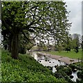
Pond, Handsworth Park
This is the smaller of the two ponds in the park, though still large enough for its own small island. wider, eastern, end, can be seen at
Image On Handsworth Park see its Historic England list entry https://historicengland.org.uk/listing/the-list/list-entry/1001473?section=official-list-entry .
Image: © A J Paxton
Taken: 22 Apr 2023
0.16 miles
5
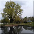
Pond, poplar and bandstand, Handsworth Park
Handsworth Park is a late 19th century public park, formerly known as Victoria Park, and now managed by the city of Birmingham, with active support from voluntary groups. For more on its history, see the Historic England site https://historicengland.org.uk/listing/the-list/list-entry/1001473?section=official-list-entry .
Here we see a fine black poplar coming into leaf in late April and reflected in one of the park's two large ponds. The tree is a wild black poplar, Populus nigra subspecies betulifolia, according to the Woodland Trust tree inventory https://ati.woodlandtrust.org.uk/tree-search/tree?treeid=48371&from=3523&v=2283184&ml=map&z=16&nwLat=52.51181053354219&nwLng=-1.9397488484965453&seLat=52.50704370581322&seLng=-1.9126478086100707#/ . This is the native black poplar of Britain and northwestern Europe, although in this location it is likely to have been planted rather than being naturally occurring.
The bandstand is a Grade II listed building and was made in Scotland in 1903 by the Lion Foundry Company of Kirkintilloch, according to the listing at Historic England https://historicengland.org.uk/listing/the-list/list-entry/1211912?section=official-list-entry . It was restored for the reopening of the park in 2006; see
Image
Image: © A J Paxton
Taken: 22 Apr 2023
0.17 miles
6
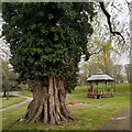
Black poplar and bandstand, Handsworth Park
The tree is a wild black poplar, Populus nigra subspecies betulifolia, with a trunk (shaggy with ivy) of 5.28m girth at a height of 1.5m, according to the Woodland Trust tree inventory https://ati.woodlandtrust.org.uk/tree-search/tree?treeid=48371&from=3523&v=2283184&ml=map&z=16&nwLat=52.51181053354219&nwLng=-1.9397488484965453&seLat=52.50704370581322&seLng=-1.9126478086100707#/. This is the native black poplar of Britain and northwestern Europe, although in this location it is likely to be a planted ornamental tree rather than one that occurs here naturally.
The bandstand is a Grade II listed building and was made in Scotland in 1903 by the Lion Foundry Company of Kirkintilloch, according to the listing at Historic England https://historicengland.org.uk/listing/the-list/list-entry/1211912?section=official-list-entry . It was restored for the reopening of the park in 2006; see
Image Inner Birmingham is not well-provided with green spaces, and the park is extremely well-used and appreciated by local people. A baby-welcoming gathering was taking place in the bandstand.
Image: © A J Paxton
Taken: 22 Apr 2023
0.17 miles
7
Handsworth Cricket Club
A match is underway under a leaden sky on a September afternoon in Handsworth Park.
Image: © A J Paxton
Taken: 3 Sep 2022
0.18 miles
8
A pair of poplars, Handsworth Park
To the right, and nearer the viewer, stands a Lombardy poplar, with its distinctive fastigiate habit (branches upright and branched together), to the left beyond the bandstand can be seen a native black poplar; they are both coming into leaf in late April. Both are subspecies of the black poplar, Populus nigra.
Image: © A J Paxton
Taken: 22 Apr 2023
0.18 miles
9
Junction of Church Lane and Selbourne Road
Image: © Peter Whatley
Taken: 2 Oct 2008
0.19 miles
10
"The Sunk Garden", Handsworth Park
The white stone in the centre was formerly the base for a bronze sculpture of a child holding a lamb. The statue was unveiled on 15 January 1937 and was designed by John P. Walker. Unfortunately it was stolen in 1988 and has not been recovered.
Image: © Neil Theasby
Taken: 19 Oct 2014
0.20 miles


