
IMAGES TAKEN NEAR TO
Hazelhurst Road, BIRMINGHAM, B14 7PJ
Introduction
This page details the photographs taken nearby to Hazelhurst Road, B14 7PJ by members of the Geograph project.
The Geograph project started in 2005 with the aim of publishing, organising and preserving representative images for every square kilometre of Great Britain, Ireland and the Isle of Man.

There are currently over 7.5m images from over14,400 individuals and you can help contribute to the project by visiting https://www.geograph.org.uk
Image Map
Images are licensed for reuse under creativecommons.org/licenses/by-sa/2.0
Notes
- Clicking on the map will re-center to the selected point.
- The higher the marker number, the further away the image location is from the centre of the postcode.
Image Listing (17 Images Found)
Images are licensed for reuse under creativecommons.org/licenses/by-sa/2.0
Image
Details
Distance
1

Modal Filters, Hazelhurst Road
The obstructions in the road are called 'modal filters' because they allow only certain types of traffic to pass. They were sited in early 2020 and are among many in the Moseley and Kings Heath area; part of an experimental and controversial LTN (low traffic neighbourhood).
Image: © Paul Collins
Taken: 14 May 2021
0.06 miles
2

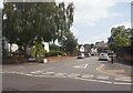
Verge, Howard Road
Howard Road has a beautiful wide verge on the northern side. It retains a few original hedgerow trees from before the area was developed and was no doubt originally land reserved for a dual carriageway and/or tram line. The verge was added to Howard Road when the houses were built along it. The road itself is slightly older, laid out and built sometime between 1903 and 1913.
Image: © Paul Collins
Taken: 14 May 2021
0.07 miles
3
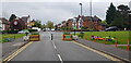
Modal Filters, All Saints Road
The obstructions in the road are called 'modal filters' because they allow only certain types of traffic to pass. They were sited in early 2020 and are among many in the Moseley and Kings Heath area; part of an experimental and controversial LTN (low traffic neighbourhood).
Image: © Paul Collins
Taken: 14 May 2021
0.08 miles
5
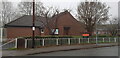
Quaker Meeting House, Colmore Road
Seen on a gloomy winter's day. The building on the right is a Scout hut.
Image: © Paul Collins
Taken: 26 Dec 2021
0.14 miles
6
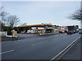
Shell petrol station on Alcester Road South
Petrol at £1.229 per litre, diesel at £1.279 per litre, a couple of weeks before Christmas 2019
Image: © Richard Law
Taken: 16 Dec 2019
0.14 miles
7
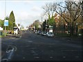
Howard Road traffic lights, Alcester Road (A435)
Image: © Peter Whatley
Taken: 7 Dec 2011
0.15 miles
8
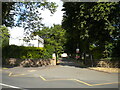
Driveway to King Edward VI Camp Hill Schools, King's Heath
Off Vicarage Road.
Image: © Richard Vince
Taken: 9 Jul 2022
0.17 miles
9
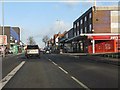
Entry to Kings Heath shopping area
That's Bargain Booze on the right, not "Ooze".
Image: © Peter Whatley
Taken: 7 Dec 2011
0.17 miles
10
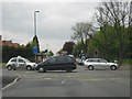
Howard Road / Alcester Road South junction
Busy road junction, just south of Kings Heath, looking towards Kings Heath
Image: © Michael Westley
Taken: 14 May 2010
0.19 miles