
IMAGES TAKEN NEAR TO
Castle Road, ST. ALBANS, AL1 5FJ
Introduction
This page details the photographs taken nearby to Castle Road, AL1 5FJ by members of the Geograph project.
The Geograph project started in 2005 with the aim of publishing, organising and preserving representative images for every square kilometre of Great Britain, Ireland and the Isle of Man.

There are currently over 7.5m images from over14,400 individuals and you can help contribute to the project by visiting https://www.geograph.org.uk
Image Map
Images are licensed for reuse under creativecommons.org/licenses/by-sa/2.0
Notes
- Clicking on the map will re-center to the selected point.
- The higher the marker number, the further away the image location is from the centre of the postcode.
Image Listing (36 Images Found)
Images are licensed for reuse under creativecommons.org/licenses/by-sa/2.0
Image
Details
Distance
1
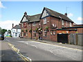
St Albans: The Rats Castle, Fleetville
The Rats Castle is on Hatfield Road at its junction with Sutton Road from which this image was taken. The Rats Castle is not a unique name for a pub, a Google search revealing another in Guildford, and a restaurant in Faringdon in Oxfordshire. The alignment of the gable end walls in the photo appears to show some distortion in the photograph, but this is the true arrangement, the flank wall visible to the right being parallel with the Hatfield Road frontage out of sight around the corner in the distance.
Image: © Nigel Cox
Taken: 19 May 2009
0.05 miles
2
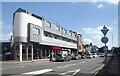
TREK Bike Centre, Hatfield Road
Bike sales and service centre on a triangular corner site.
Image: © Des Blenkinsopp
Taken: 25 Aug 2024
0.06 miles
4
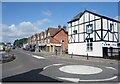
Hatfield Road, St Albans
The main road east out of St Albans to the next town along.
A picture at the mini roundabout by the junction with Sutton Road
Image: © Des Blenkinsopp
Taken: 25 Aug 2024
0.08 miles
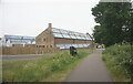
6
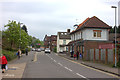
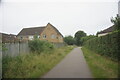
Sutton Road, Fleetville. Looking northwards.
Taken from the Alban Way crossing
Image: © Robert Eva
Taken: 6 May 2017
0.09 miles
7
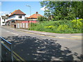
St Albans: Former railway crossing at Sutton Road
The Hatfield and St Albans Railway was completed in 1865 and was taken over by the Great Northern Railway in 1883. It was a very early casualty of British Railways' days being closed to passenger traffic in 1951. Freight services lingered on until 1964. This is the point at which the railway crossed Sutton Road with the raised grassy bank on the right being on the former track bed. The trackbed itself is now a public path known as the Alban Way and it also forms a section of National Cycle Network Route 61 as the sign on the right bears witness.
Image: © Nigel Cox
Taken: 19 May 2009
0.09 miles
8
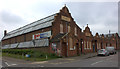
Beaumont Works, Sutton Road
Now closed and boarded up.
Image: © Robert Eva
Taken: 6 May 2017
0.09 miles
9
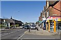
Hatfield Road
Hatfield Road in the Fleetville area of St Albans. On the left is Morrison's Supermarket, built on the site of what was from the 1920s to 1967 the works of Ballito Hosiery and then for a while a factory of Marconi Instruments, eventually part of the electrical and engineering conglomerate GEC.
Image: © Ian Capper
Taken: 20 Apr 2013
0.09 miles
10
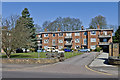
Queens Court
1950s apartments on Hatfield Road.
Image: © Ian Capper
Taken: 20 Apr 2013
0.10 miles