
IMAGES TAKEN NEAR TO
Hatfield Road, ST. ALBANS, AL1 3RW
Introduction
This page details the photographs taken nearby to Hatfield Road, AL1 3RW by members of the Geograph project.
The Geograph project started in 2005 with the aim of publishing, organising and preserving representative images for every square kilometre of Great Britain, Ireland and the Isle of Man.

There are currently over 7.5m images from over14,400 individuals and you can help contribute to the project by visiting https://www.geograph.org.uk
Image Map
Images are licensed for reuse under creativecommons.org/licenses/by-sa/2.0
Notes
- Clicking on the map will re-center to the selected point.
- The higher the marker number, the further away the image location is from the centre of the postcode.
Image Listing (351 Images Found)
Images are licensed for reuse under creativecommons.org/licenses/by-sa/2.0
Image
Details
Distance
1
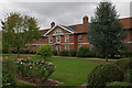
Marlborough Buildings
Built by Sarah, Duchess of Marlborough, in 1736, who was born in St Albans and whose family were major landowners there. They consist of a central block (seen here) including a bay topped by a pediment bearing the Marlborough arms. At either end of this block are two similar wings, with the whole set of buildings enclosing a mainly grass courtyard. There are 36 flats in all, in nine blocks of four.
Grade II listed - for listing particulars see www.historicengland.org.uk/listing/the-list/list-entry/1173192.
Image: © Ian Capper
Taken: 4 Oct 2011
0.00 miles
2
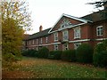
Marlborough Buildings
The central part of the façade with the Marlborough coat of arms in the pediment. The façade was rebuilt in 1850 onto the original 1736 building. Listed Grade II.
Image: © Alan Murray-Rust
Taken: 2 Nov 2015
0.01 miles
3
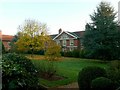
Marlborough Buildings garden
A large group of almshouses, built by Sarah, Duchess of Marlborough, in 1736, surrounding three sides of this attractive, quiet garden. The building is Listed Grade II.
Image: © Alan Murray-Rust
Taken: 2 Nov 2015
0.01 miles
4
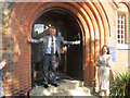
The Mayor opens the Museum of St Albans on the final day
The Mayor of St Albans, Councillor Salih Gaygusuz, opens the door of the museum for the last time, after having been introduced by the Portfolio Holder, Councillor Annie Brewster.
Image: © Chris Reynolds
Taken: 20 Sep 2015
0.03 miles
5
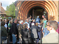
Crowds entering the Museum on its final day
Possibly 150 people turned up for the ceremony of opening the doors for the last time.
Image: © Chris Reynolds
Taken: 20 Sep 2015
0.03 miles
6
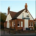
Former Liberal club
Currently an Asian restaurant, this having changed since Ian Capper's view from 4 years previously http://www.geograph.org.uk/photo/2705796 .
The original use is still clearly indicated by the ornate terracotta panels over the windows http://www.geograph.org.uk/photo/4745555 http://www.geograph.org.uk/photo/4745558 ,and there is a datestone, also (probably, although painted over) of terracotta, with the date 1899 http://www.geograph.org.uk/photo/4745557. Locally listed as part of the Conservation Area.
Image: © Alan Murray-Rust
Taken: 2 Nov 2015
0.03 miles
7
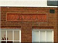
Liberal (Club)
Terracotta panel on the former Liberal Club http://www.geograph.org.uk/photo/4745554 http://www.geograph.org.uk/photo/4745558
Image: © Alan Murray-Rust
Taken: 2 Nov 2015
0.03 miles
8
Datestone, former Liberal Club
See http://www.geograph.org.uk/photo/4745554
Image: © Alan Murray-Rust
Taken: 2 Nov 2015
0.03 miles
9
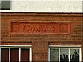
(Liberal) Club
Terracotta panel on the former Liberal Club http://www.geograph.org.uk/photo/4745554 http://www.geograph.org.uk/photo/4745555
Image: © Alan Murray-Rust
Taken: 2 Nov 2015
0.03 miles
10
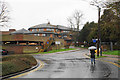
Bricket Road in the rain
The Civic Centre is behind.
Image: © Bill Boaden
Taken: 28 Feb 2020
0.03 miles