Marlborough Buildings
Introduction
The photograph on this page of Marlborough Buildings by Ian Capper as part of the Geograph project.
The Geograph project started in 2005 with the aim of publishing, organising and preserving representative images for every square kilometre of Great Britain, Ireland and the Isle of Man.

There are currently over 7.5m images from over 14,400 individuals and you can help contribute to the project by visiting https://www.geograph.org.uk
Marlborough Buildings
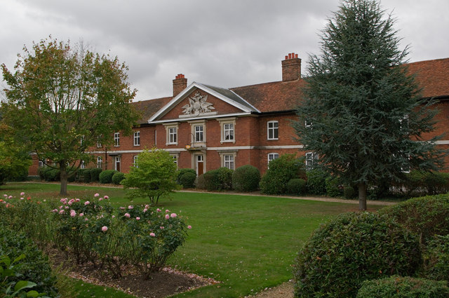
Image: © Ian Capper Taken: 4 Oct 2011
Built by Sarah, Duchess of Marlborough, in 1736, who was born in St Albans and whose family were major landowners there. They consist of a central block (seen here) including a bay topped by a pediment bearing the Marlborough arms. At either end of this block are two similar wings, with the whole set of buildings enclosing a mainly grass courtyard. There are 36 flats in all, in nine blocks of four. Grade II listed - for listing particulars see www.historicengland.org.uk/listing/the-list/list-entry/1173192.
Images are licensed for reuse under creativecommons.org/licenses/by-sa/2.0
Image Location


Leaflet Map data © OpenStreetMap
Latitude
51.753825
Longitude
-0.334456