IMAGES TAKEN NEAR TO
Chantry Lane, HATFIELD, AL10 9HR
Introduction
This page details the photographs taken nearby to Chantry Lane, AL10 9HR by members of the Geograph project.
The Geograph project started in 2005 with the aim of publishing, organising and preserving representative images for every square kilometre of Great Britain, Ireland and the Isle of Man.

There are currently over 7.5m images from over14,400 individuals and you can help contribute to the project by visiting https://www.geograph.org.uk
Image Map
Images are licensed for reuse under creativecommons.org/licenses/by-sa/2.0
Notes
- Clicking on the map will re-center to the selected point.
- The higher the marker number, the further away the image location is from the centre of the postcode.
Image Listing (20 Images Found)
Images are licensed for reuse under creativecommons.org/licenses/by-sa/2.0
Image
Details
Distance
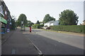
7
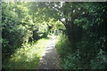
Path off Bishops Rise, Hatfield
Towards Roe Hill Park.
Image: © Ian S
Taken: 19 Jun 2022
0.21 miles
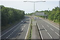
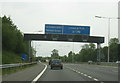
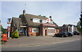
10
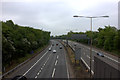
A1(M) from Cavendish Way
Looking southwards from where the motorway exits the Hatfield tunnel
Image: © Robert Eva
Taken: 6 May 2017
0.22 miles