IMAGES TAKEN NEAR TO
Breaks Road, HATFIELD, AL10 8TR
Introduction
This page details the photographs taken nearby to Breaks Road, AL10 8TR by members of the Geograph project.
The Geograph project started in 2005 with the aim of publishing, organising and preserving representative images for every square kilometre of Great Britain, Ireland and the Isle of Man.

There are currently over 7.5m images from over14,400 individuals and you can help contribute to the project by visiting https://www.geograph.org.uk
Image Map
Images are licensed for reuse under creativecommons.org/licenses/by-sa/2.0
Notes
- Clicking on the map will re-center to the selected point.
- The higher the marker number, the further away the image location is from the centre of the postcode.
Image Listing (31 Images Found)
Images are licensed for reuse under creativecommons.org/licenses/by-sa/2.0
Image
Details
Distance
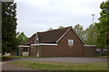
1
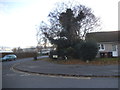
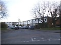
Link Drive at the junction of Old Rectory Drive
Image: © David Howard
Taken: 25 Nov 2017
0.04 miles
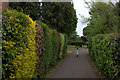
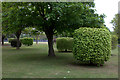
4
Park on Queensway, Hatfield
A small piece of green space on Queensway opposite the town centre
Image: © Robert Eva
Taken: 6 May 2017
0.12 miles
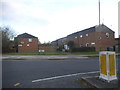
6
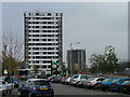
High rise housing in Hatfield town centre
Taken from a supermarket car park, these blocks of flats look better from here than they do close up.
Image: © Robin Hall
Taken: 23 Nov 2005
0.15 miles
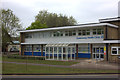
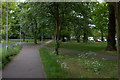
10
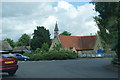
Roundabout by St Luke's Church, Hatfield
Image: © Bill Boaden
Taken: 1 Jul 2012
0.17 miles