IMAGES TAKEN NEAR TO
Fordyce Road, TURRIFF, AB53 6SB

Introduction

This page details the photographs taken nearby to Fordyce Road, AB53 6SB by members of the Geograph project.

The Geograph project started in 2005 with the aim of publishing, organising and preserving representative images for every square kilometre of Great Britain, Ireland and the Isle of Man.

There are currently over 7.5m images from over14,400 individuals and you can help contribute to the project by visiting https://www.geograph.org.uk

Image Map


Images are licensed for reuse under creativecommons.org/licenses/by-sa/2.0
Notes
  • Clicking on the map will re-center to the selected point.
  • The higher the marker number, the further away the image location is from the centre of the postcode.

Image Listing (31 Images Found)

Images are licensed for reuse under creativecommons.org/licenses/by-sa/2.0
  • ...
Image
Details
Distance
1
New Deer Villa
A fine granite villa beside the kirk with bow windows and stylised battlements above.
Image: © Bill Harrison Taken: 2 Apr 2016
0.11 miles
2
New Deer telephone exchange
The telephone exchange is hidden amongst the back lanes of New Deer. Visible to the left is New Deer school and to the right a warehouse used for the supply of veg boxes.
Image: © Haworth Hodgkinson Taken: 9 Oct 2016
0.12 miles
3
New Deer primary school
The fine original 1840s granite building is just visible behind the 'worthless post-war additions', as the Buildings of Scotland (Pevsner) Guide sardonically puts it.
Image: © Bill Harrison Taken: 2 Apr 2016
0.12 miles
4
Fordyce Terrace, New Deer
Image: © Richard Webb Taken: 2 Aug 2020
0.14 miles
5
Former Free Kirk
The former Free Kirk is now a council-owned community hall. It dates from 1885, and the architects were Ellis and Wilson.
Image: © Anne Burgess Taken: 14 May 2009
0.14 miles
6
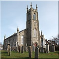
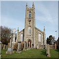
St Kane's Kirk, New Deer (II)
See: http://www.geograph.org.uk/photo/4898269 for more.
Image: © Bill Harrison Taken: 2 Apr 2016
0.14 miles
7
St Kane's Kirk, New Deer (I)
New Deer was established as a model village in ca. 1805 and a church was an essential building. The parish kirk dedicated to St Kane in Tudor style was designed by Aberdeen architect John Smith, although construction of the tower was delayed by some 25 years. St Kane is an enigmatic figure but it is proposed that he left Old Deer monastery located a few kilometres to the east to set up a hermitage (later a chapel) near the site of this church.
Image: © Bill Harrison Taken: 2 Apr 2016
0.14 miles
8
St Kane's Kirk, New Deer (III)
For more, see: http://www.geograph.org.uk/photo/4898269 . The A981 loops around the church.
Image: © Bill Harrison Taken: 2 Apr 2016
0.14 miles
9
New Deer Public Hall
A substantial granite structure opposite the church.
Image: © Bill Harrison Taken: 2 Apr 2016
0.14 miles
10
Former Free Kirk
This kirk seems to date from 1885, designed by Alexander Ellis and Robert Gordon Wilson. It is now owned by Aberdeenshire Council and serves as a community hall.
Image: © Anne Burgess Taken: 14 May 2009
0.15 miles
  • ...