
IMAGES TAKEN NEAR TO
Seaview Road, BANFF, AB45 2UE
Introduction
This page details the photographs taken nearby to Seaview Road, AB45 2UE by members of the Geograph project.
The Geograph project started in 2005 with the aim of publishing, organising and preserving representative images for every square kilometre of Great Britain, Ireland and the Isle of Man.

There are currently over 7.5m images from over14,400 individuals and you can help contribute to the project by visiting https://www.geograph.org.uk
Image Map
Images are licensed for reuse under creativecommons.org/licenses/by-sa/2.0
Notes
- Clicking on the map will re-center to the selected point.
- The higher the marker number, the further away the image location is from the centre of the postcode.
Image Listing (24 Images Found)
Images are licensed for reuse under creativecommons.org/licenses/by-sa/2.0
Image
Details
Distance
1
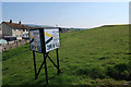
Land for sale, Sandend
2.2 acres of residential development land.
Image: © Hugh Venables
Taken: 22 Apr 2019
0.06 miles
2
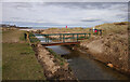
Bridge to Sandend Beach
A footbridge over the Scattery Burn, from Sandend Caravan Park to Sandend Beach.
Image: © Craig Wallace
Taken: 26 Feb 2022
0.09 miles
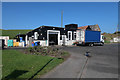
4
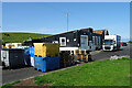
The Fish House
These are the premises of Messrs J Smt, fish merchants, with deliveries to a wide area of north-east Scotland.
Image: © Anne Burgess
Taken: 20 Jul 2021
0.11 miles
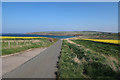
6
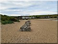
Sandend beach, Aberdeenshire
Coastal defences from World War Two can still be seen on the beach at Sandend.
Image: © Euan Nelson
Taken: 28 Aug 2019
0.13 miles
7
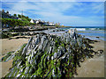
Sandend: the village, the beach and rocks
Sandend, an old fishing village with roots in the 17th Century, has an excellent beach and is a favourite with families and surfers alike. The stratified rocks in the area have been turned through 90 degrees by geological forces and the layers now point to the sky.
Image: © Martyn Gorman
Taken: 27 Jun 2009
0.13 miles
8
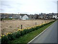
Sandend Bridge.
Houses situated at Sandend Bridge between Sandend and the main road.
Image: © Christopher Gillan
Taken: 12 Apr 2006
0.14 miles
9
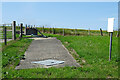
Sewage Pumping Station
Only be referring to the map is it clear what the function of this facility is, as the sign has faded into illegibility.
Image: © Anne Burgess
Taken: 20 Jul 2021
0.16 miles
10
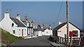
Sandend
The street leading to the harbour. Creel Cottage, on the right, is apparently let as a holiday cottage.
Image: © Anne Burgess
Taken: 26 Mar 2007
0.17 miles