Sandend: the village, the beach and rocks
Introduction
The photograph on this page of Sandend: the village, the beach and rocks by Martyn Gorman as part of the Geograph project.
The Geograph project started in 2005 with the aim of publishing, organising and preserving representative images for every square kilometre of Great Britain, Ireland and the Isle of Man.

There are currently over 7.5m images from over 14,400 individuals and you can help contribute to the project by visiting https://www.geograph.org.uk
Sandend: the village, the beach and rocks
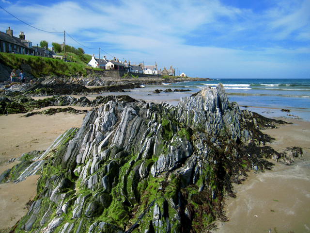
Image: © Martyn Gorman Taken: 27 Jun 2009
Sandend, an old fishing village with roots in the 17th Century, has an excellent beach and is a favourite with families and surfers alike. The stratified rocks in the area have been turned through 90 degrees by geological forces and the layers now point to the sky.
Images are licensed for reuse under creativecommons.org/licenses/by-sa/2.0
Image Location
Latitude
57.683434
Longitude
-2.74792