IMAGES TAKEN NEAR TO
BANFF, AB45 2TD

Introduction

This page details the photographs taken nearby to AB45 2TD by members of the Geograph project.

The Geograph project started in 2005 with the aim of publishing, organising and preserving representative images for every square kilometre of Great Britain, Ireland and the Isle of Man.

There are currently over 7.5m images from over14,400 individuals and you can help contribute to the project by visiting https://www.geograph.org.uk

Image Map


Images are licensed for reuse under creativecommons.org/licenses/by-sa/2.0
Notes
  • Clicking on the map will re-center to the selected point.
  • The higher the marker number, the further away the image location is from the centre of the postcode.

Image Listing (24 Images Found)

Images are licensed for reuse under creativecommons.org/licenses/by-sa/2.0
  • ...
Image
Details
Distance
1
Ordnance Survey Flush Bracket G944
This can be found on the wall of a house at Scotsmill. For more detail see : http://www.bench-marks.org.uk/bm17668
Image: © Peter Wood Taken: 6 Oct 2012
0.01 miles
2
Scotsmill Bridge
The category B listed Scotsmill Bridge over the Burn of Boyne dates from the late 18th-century. Difficult to photograph, as the southern arch is part of the garden of Scotsmill Mill and the northern arch is in a deep gorge that could only be approached through another private residence. https://britishlistedbuildings.co.uk/200334225-scotsmill-mill-and-former-steading-banff-and-district-ward#.W40JaMInZaQ
Image: © valenta Taken: 25 Aug 2018
0.01 miles
3
A modern villa near Scotsmill
On a minor road approaching the B9139 from the south. The house on the right is Brangan Cottage on the B9139, between Portsoy and Whitehills.
Image: © Stanley Howe Taken: 23 Jul 2015
0.06 miles
4
The B9139 down to Scotsmill Bridge
The single track B9139 runs from Portsoy to the outskirts of Banff, seen here on the downhill approach to Scotsmill Bridge
Image: © valenta Taken: 25 Aug 2018
0.07 miles
5
Scotsmill near Portsoy
Though the cottage looks to be quietly situated it is very close to a quarry and a wind turbine site which is under construction
Image: © Christopher Gillan Taken: 12 Apr 2006
0.11 miles
6
Fields above Boyne Bay
Image: © David Purchase Taken: 11 Jun 2019
0.16 miles
7
Boyne Castle
The main western end of the late 16th century Boyne Castle. There are numerous rooms under this part of the castle still in relatively good condition, as in here Image]
Image: © valenta Taken: 25 Aug 2018
0.16 miles
8
Plaque on Boyne Castle
This plaque on Boyne Castle refers to the Ancient Monuments Acts of 1913 and 1931. Judging by the ruinous state of the castle no remedial care has ever been carried out to the remains of the castle which is gradually being subsumed by trees and vegetation.
Image: © valenta Taken: 25 Aug 2018
0.16 miles
9
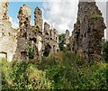
Boyne Castle
The late 16th century Boyne Castle is in a ruinous state and gradually being overwhelmed by trees and vegetation. A plaque on one of the walls of the castle suggests little has been done to maintain the castle since the 1930s Image] https://canmore.org.uk/site/18436/boyne-castle
Image: © valenta Taken: 25 Aug 2018
0.17 miles
10
Boyne Castle
Interior view of one of the barrel vaulted rooms on the ground level of the late 16th century Boyne Castle.
Image: © valenta Taken: 25 Aug 2018
0.17 miles
  • ...