
IMAGES TAKEN NEAR TO
Corn Road, FRASERBURGH, AB43 8WR
Introduction
This page details the photographs taken nearby to Corn Road, AB43 8WR by members of the Geograph project.
The Geograph project started in 2005 with the aim of publishing, organising and preserving representative images for every square kilometre of Great Britain, Ireland and the Isle of Man.

There are currently over 7.5m images from over14,400 individuals and you can help contribute to the project by visiting https://www.geograph.org.uk
Image Map
Images are licensed for reuse under creativecommons.org/licenses/by-sa/2.0
Notes
- Clicking on the map will re-center to the selected point.
- The higher the marker number, the further away the image location is from the centre of the postcode.
Image Listing (7 Images Found)
Images are licensed for reuse under creativecommons.org/licenses/by-sa/2.0
Image
Details
Distance
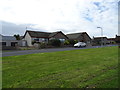
2
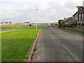
Dundas Road beside Rathen Road (B9107) at Cairnbulg, Inverallochy
Looking north-eastward.
Image: © Peter Wood
Taken: 20 Nov 2019
0.11 miles
3
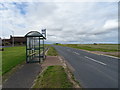
Bus stop and shelter on Rathen Road (B9107), Inverallochy
Image: © JThomas
Taken: 22 Aug 2020
0.12 miles
4
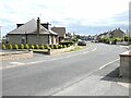
Rathen Road
Cairnbulg to the left, Inverallochy to the right - bungalows on the B9107 on the road in to the twin fishing villages.
Image: © Oliver Dixon
Taken: 11 Jun 2021
0.16 miles
5
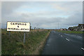
Approaching Cairnbulg and Inverallochy.
Image: © Des Colhoun
Taken: 21 Jan 2007
0.20 miles
6
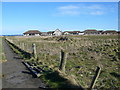
Modern housing estate at Cairnbulg/Inverallochy
Image: © Iain Macaulay
Taken: 6 Mar 2007
0.23 miles
7
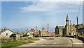
Cairnbulg: site of station, 1988
View NE on B9107 to Inverallochy where the ex-GNS Fraserburgh (left) - St Combs (right) light railway crossed. The station and line were closed from 3/5/65.
Image: © Ben Brooksbank
Taken: 20 Jun 1988
0.25 miles