Cairnbulg: site of station, 1988
Introduction
The photograph on this page of Cairnbulg: site of station, 1988 by Ben Brooksbank as part of the Geograph project.
The Geograph project started in 2005 with the aim of publishing, organising and preserving representative images for every square kilometre of Great Britain, Ireland and the Isle of Man.

There are currently over 7.5m images from over 14,400 individuals and you can help contribute to the project by visiting https://www.geograph.org.uk
Cairnbulg: site of station, 1988
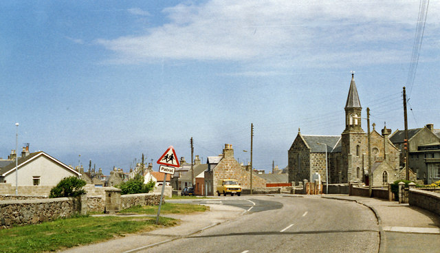
Image: © Ben Brooksbank Taken: 20 Jun 1988
View NE on B9107 to Inverallochy where the ex-GNS Fraserburgh (left) - St Combs (right) light railway crossed. The station and line were closed from 3/5/65.
Images are licensed for reuse under creativecommons.org/licenses/by-sa/2.0
Image Location
Latitude
57.67422
Longitude
-1.93259