IMAGES TAKEN NEAR TO
North Street, FRASERBURGH, AB43 7NT

Introduction

This page details the photographs taken nearby to North Street, AB43 7NT by members of the Geograph project.

The Geograph project started in 2005 with the aim of publishing, organising and preserving representative images for every square kilometre of Great Britain, Ireland and the Isle of Man.

There are currently over 7.5m images from over14,400 individuals and you can help contribute to the project by visiting https://www.geograph.org.uk

Image Map


Images are licensed for reuse under creativecommons.org/licenses/by-sa/2.0
Notes
  • Clicking on the map will re-center to the selected point.
  • The higher the marker number, the further away the image location is from the centre of the postcode.

Image Listing (39 Images Found)

Images are licensed for reuse under creativecommons.org/licenses/by-sa/2.0
  • ...
Image
Details
Distance
1
Stormy Sea Chucking Rocks all over Road
Just to show it gets wild here on occasion
Image: © Ru Taken: 27 Mar 2008
0.02 miles
2
Jennylass and Dobhran
FR980 Jennylass and OB516 Dobhran at Rosehearty Harbour.
Image: © Richard Webb Taken: 15 Apr 2015
0.08 miles
3
Bed and Breakfast in Rosehearty
This excellent B&B is in Mid Street. We booked it through the helpful Fraserburgh Tourist Office http://guide.visitscotland.com/?branchtype=accommodation .
Image: © David Hawgood Taken: 11 Sep 2007
0.09 miles
4
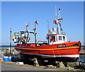
Jennylass and Dobhran under repair at Rosehearty Harbour
It sees that they have been perched on blocks for at least six years as per Richard Webb's photo from 2015: https://www.geograph.org.uk/photo/4454033
Image: © Bill Harrison Taken: 16 Apr 2021
0.10 miles
5
Rosehearty Harbour
One of the oldest seaports in Scotland, Rosehearty at one time had a fishing fleet which supported 600 people. Extending to 3400 square metres, this is a one-basin harbour which offers 120 metres of quayside inside the harbour with a further 120 metres on the outer breakwater, but this is exposed to winds from between East and North-east. Around 20 boats, most involved in part-time fishing, use the harbour regularly.
Image: © Bob Jones Taken: 25 Oct 2004
0.10 miles
6
On the blocks
The Oban registered Dobhran is out of water and far from home at Rosehearty Harbour. Dobhran means 'otter' in Scotch Gaelic.
Image: © Bill Harrison Taken: 16 Apr 2021
0.10 miles
7
Well Street, Rosehearty
A grid pattern of grey houses.
Image: © Richard Webb Taken: 15 Apr 2015
0.10 miles
8
Air Traffic Control at Rosehearty.
Not much in the way of defence cuts here with an elaborate gate like that! An area adjacent to Rosehearty over the sea is designated as a bombing range and maintained by the RAF.
Image: © Des Colhoun Taken: 21 Jan 2007
0.11 miles
9
Former bombing range observation tower, Rosehearty
This is now "Rosehearty Tower", a private residence. On 7th May 2002 The Scotsman http://thescotsman.scotsman.com/business.cfm?id=490632002 reported it was under offer as a disposal from the Ministry of Defence, adding "It comes with the added benefit of bomb-proof and bullet-proof windows." Locals told me it cost £750,000 to build and was sold for £75,000. When photographed it had two wind socks, one from a Union Flag and one from a Scottish St Andrew's Cross flag. When built it replaced a building on quarry head, see Image
Image: © David Hawgood Taken: 11 Sep 2007
0.11 miles
10
Boats on Pier at Rosehearty
Image: © Peter Moore Taken: 2 Dec 2014
0.11 miles
  • ...