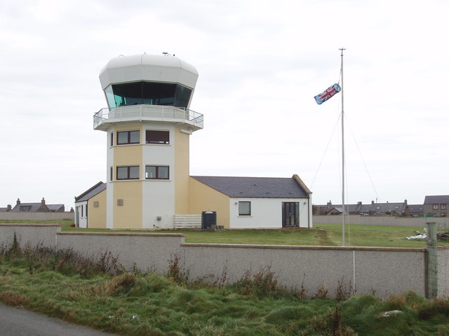
Former bombing range observation tower, Rosehearty
Introduction
The photograph on this page of Former bombing range observation tower, Rosehearty by David Hawgood as part of the Geograph project.
The Geograph project started in 2005 with the aim of publishing, organising and preserving representative images for every square kilometre of Great Britain, Ireland and the Isle of Man.
There are currently over 7.5m images from over 14,400 individuals and you can help contribute to the project by visiting https://www.geograph.org.uk

Image: © David Hawgood Taken: 11 Sep 2007
This is now "Rosehearty Tower", a private residence. On 7th May 2002 The Scotsman http://thescotsman.scotsman.com/business.cfm?id=490632002 reported it was under offer as a disposal from the Ministry of Defence, adding "It comes with the added benefit of bomb-proof and bullet-proof windows." Locals told me it cost £750,000 to build and was sold for £75,000. When photographed it had two wind socks, one from a Union Flag and one from a Scottish St Andrew's Cross flag. When built it replaced a building on quarry head, see Image

