IMAGES TAKEN NEAR TO
Churchill Drive, PETERHEAD, AB42 1NE
Introduction
This page details the photographs taken nearby to Churchill Drive, AB42 1NE by members of the Geograph project.
The Geograph project started in 2005 with the aim of publishing, organising and preserving representative images for every square kilometre of Great Britain, Ireland and the Isle of Man.

There are currently over 7.5m images from over14,400 individuals and you can help contribute to the project by visiting https://www.geograph.org.uk
Image Map
Images are licensed for reuse under creativecommons.org/licenses/by-sa/2.0
Notes
- Clicking on the map will re-center to the selected point.
- The higher the marker number, the further away the image location is from the centre of the postcode.
Image Listing (22 Images Found)
Images are licensed for reuse under creativecommons.org/licenses/by-sa/2.0
Image
Details
Distance
6
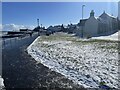
Buchanhaven shore
The old fishing village now just part of Peterhead
Image: © Ralph Greig
Taken: 8 Mar 2023
0.09 miles
7
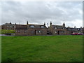
Houses on Harbour Street, Buchanhaven, Peterhead
Image: © JThomas
Taken: 21 Aug 2020
0.11 miles
8
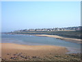
Buchanhaven, Peterhead
The Buchanhaven area of the town, viewed from "Ower the Water" which is the golf course side of the River Ugie reached by the Birnie Memorial Bridge as previously submitted in this grid square by Ken Fitlike.
Image: © Jim Davidson
Taken: 6 Feb 2003
0.12 miles
9
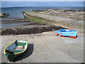
Buchanhaven Harbour
In 1850 work started on a new pier, to replace an earlier small one to the west. This was to be the first stage in the building of a proper harbour basin for large herring boats. This plan was never completed. Buchanhaven Pier, as it stands today, did allow the fishermen to operate small-line boats. By the mid 1860s there were 27 boats working from the harbour.
The proximity of Peterhead and other larger fishing harbours eventually led to the demise of the harbour and nowadays only a few small boats use it.
Image: © Bob Jones
Taken: 14 May 2011
0.12 miles